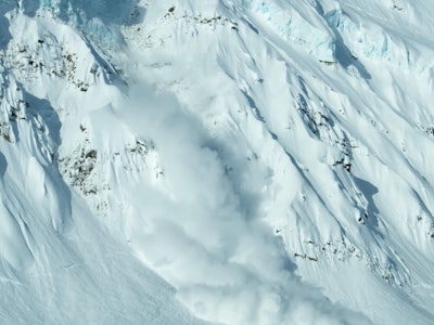
Climate change has been rearing its ugly head this winter, leaving many mountains across the Western United States barren or, worse, littered with volatile weak layers. Since our last State of the Snowpack about a month ago, much of the Mountain West has experienced another extended period of high pressure with a wide mixture of temperatures. While the Pacific Northwest saw a lot of rain and the intercontinental mountains were dealt an early spring, snowpacks suffered the second half of January.
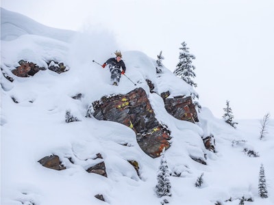
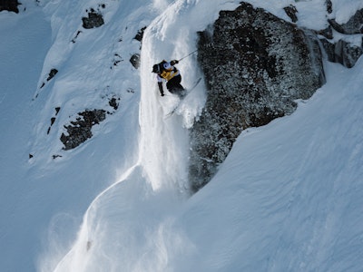
Despite what the groundhog saw or didn’t see, winter has made its return with heavy snowfall across the Sierra, Cascades, Rockies, and Mid-Atlantic. Resort skiers rejoice, your favorite lines, hits and cliffs are likely filled in again, but this kind of weather pattern spells disaster for the backcountry. Last weekend, two separate avalanche incidents near Crested Butte, Colorado, left one snowboarder severely injured and a pillar in the local ski community dead.
Below you will find a brief assessment of the current snowpacks across the Mountain West, according to each region’s avalanche center. From Washington and Oregon to California, Idaho, Montana, Wyoming, Utah and Colorado, we are here to help disseminate the information provided by real professionals. Moral of the story in the West right now: be selective and conservative with terrain choice right now, we are dealing with an unprecedented snowpack.
Note: This is not an exhaustive list, so please be sure to monitor your local forecasting center for the most accurate reports and check back here mid-season for another avy assessment across the western United States.
California
Sierra Avalanche Center
While the Central Sierras are not dealing with a persistent weak layer as the number one avalanche problem, heavy snowfall and gale-force winds have created wind slabs and storm slabs bad enough to warrant an avalanche warning for the entire zone. All aspects and elevations are rated as high avy danger as of Monday, February 19, and a deep, persistent weak layer is not totally off of the discussion table.
Colorado
Colorado Avalanche Center
The majority of Colorado is rated as moderate or considerable avalanche danger as new storm snow and high winds create heightened problems where the newly consolidated slabs have yet to bond to the old snow surface. Two recent avalanche incidents, which resulted in one fatality and one serious injury, should be clear indicators of the dangerous snowpack all of Colorado is dealing with.
Idaho
Sawtooth Avalanche Center
The Sawtooths are touchy right now, warranting a considerable avalanche rating across all zones in the upper and middle elevations. Heavy snowfall and winds have created a wind slab problem on top of the existing persistent weak layer problem, but what makes this snowpack so scary is the inconsistencies throughout different aspects and elevations. Triggering avalanches anywhere from one to four feet deep is likely right now, but it’s not easy to predict where you’re most likely to trigger these dangerous slides.
Montana
Gallatin National Forest Avalanche Center
Montana is seeing natural and remotely triggered avalanches left and right, which makes sense, given the considerable avalanche rating across all forecasting zones. Travel in, below and above avalanche terrain is not recommended.
Oregon
Central Oregon Avalanche Center
Central Oregon is dealing with three avalanche problems at the moment, the biggest one being a persistent weak layer on all aspects and elevations, with wind slabs and storm slabs adding to the already tumultuous mixture. As with much of the United States, extreme caution needs to be taken while traveling in the backcountry right now.
Utah
Utah Avalanche Center
While Southern Utah is still in the moderate avalanche rating, every northern zone, including Logan, Wasatch, Uintas, Ogden, Salt Lake and Provo, is rated as considerable due to the high volume of snowfall in the last couple of days and strong winds in the upper elevations. A persistent weak layer is still a problem, but it’s currently wind-drifted slabs that are of most concern at the moment.
Washington
Northwest Avalanche Center
While Northern Washington isn’t seeing the same level of avalanche danger as the Mt. Hood zone due to the amount of rain the state has seen in the last month, triggering large and dangerous avalanches is still very much a possibility on wind-loaded slopes. As you climb higher onto volcanoes in the West Slopes South and Mt. Hood forecast zones, avalanche risk increases due to high snowfall amounts.
Wyoming
Bridger-Teton Avalanche Center
While the Tetons are rated as moderate today, Togwotee Pass and the Greys River zones remain considerable at upper elevations due to the persistent weak layer that has not healed. Thin, rocky zones and wind-drifted areas are the biggest concern right now, thanks to heavy snowfall and high winds the last couple of weeks. Natural and triggered slides are happening everywhere right now, and extreme caution should be used if traveling in and around steep terrain.