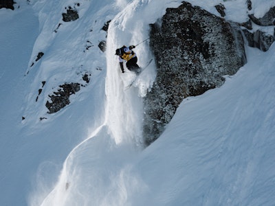

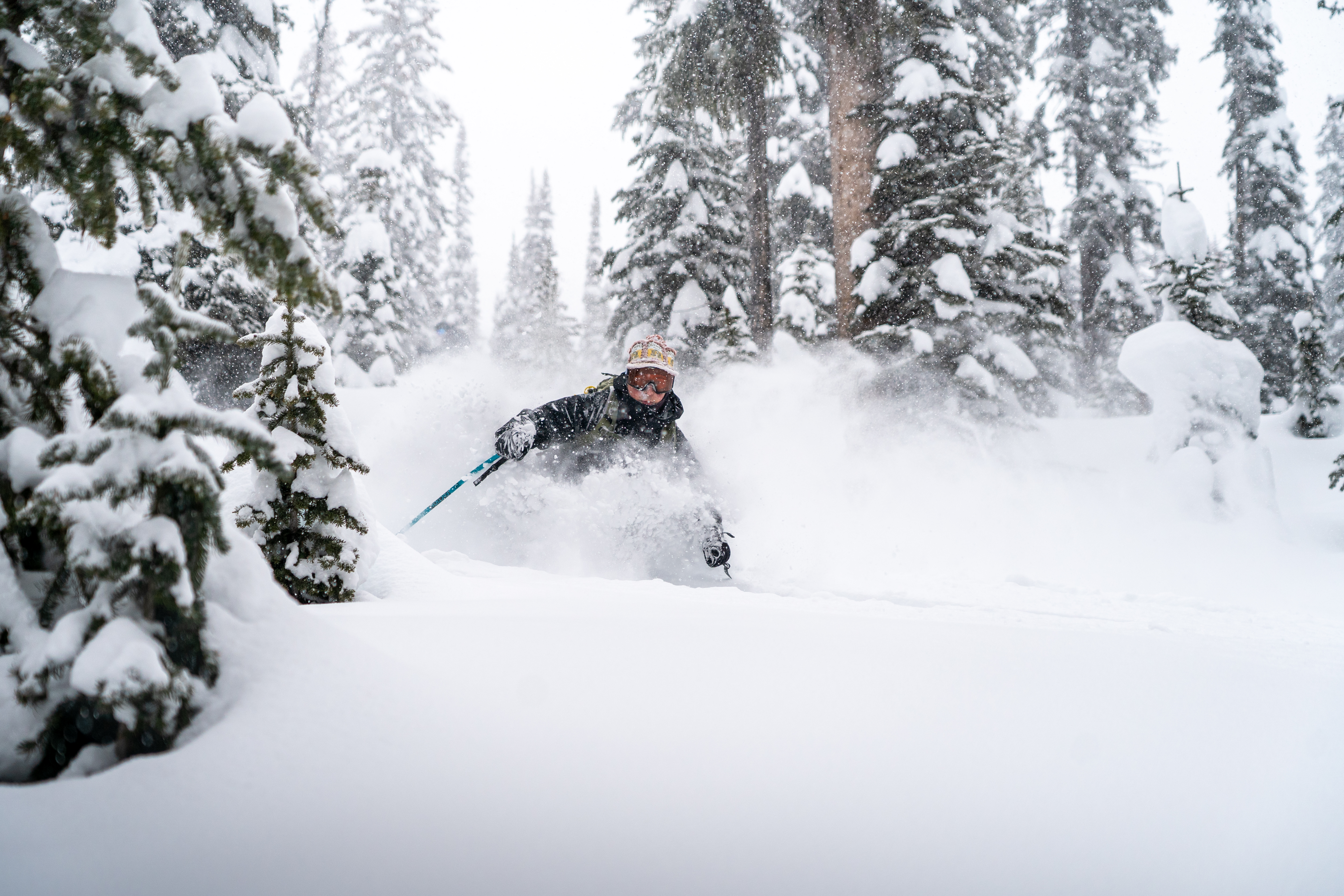
Featured Image: Courtesy of Valle Nevado Resort
In South America, Chile and Argentina have already seen historic early-season snowfalls at high elevations, and another round of intense snow is on the way. Valle Nevado, among other prominent resorts, announced an early opening last week thanks to these early storms. The original opening was slated for June 21st, an understandable date when considering yearly storm patterns in the Andes Mountains. However, storms at the end of May allowed them to bump opening day up to June 7th. It takes multiple feet of snow to allow a resort to shift its opening that dramatically. As the season is just taking off, these resorts are bracing for a second wave of miraculous moisture.
In times of forecast fever, when you just want the right pow predictions but don’t know where to look, we turn to our friends at Open Snow. No, this is not a paid ad. Yes, they’re really that good. Their data suggests that over the next 10 days, the most snow will find its way to the high regions of the Chilean Andes. This is because we’re still seeing warmer temps at some of the lower areas, which is more likely to translate into sleet and snow in the early phases of this storm cycle. However, later in the week and moving into next, the faucet is set to open more across the board as snow settles in at lower elevations.

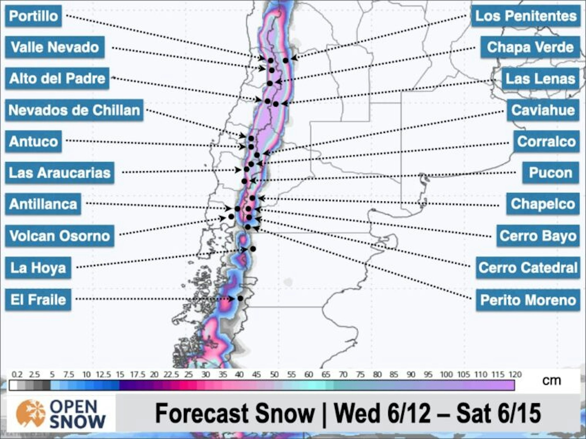
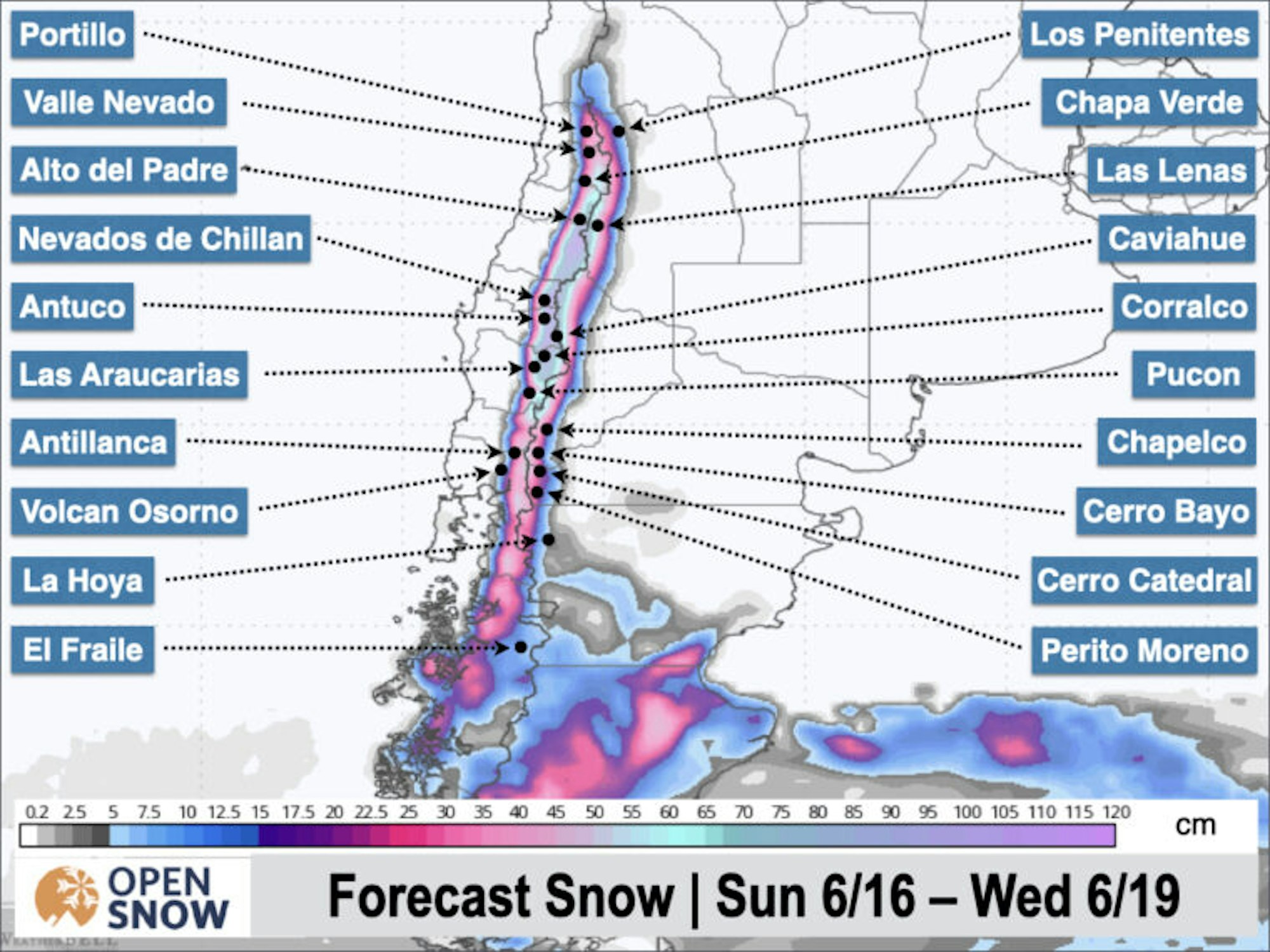
Map Courtesy of Open Snow
Above is a map of the sprawling Andes Mountains, running inland along the South American west coast. Like a natural border stretching into the sky, they divide the coastal country of Chile (left) from the neighboring Argentina (right). The highest-elevation regions mentioned above are primarily positioned in the top part of this map. As can deciphered by the color gradient, that area is expected to see the most snow from today, Wednesday 6/12, until Saturday 6/15.
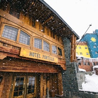
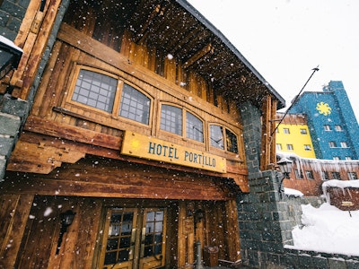
This hot zone includes resorts such as Valle Nevado, which forecasts from a staggering elevation of just over 10,700 ft, La Parva, forecasting from 10,500 ft, and Portillo, forecasting from an elevation of 9,777 ft. These solitary alpine outposts are in for an incredibly deep and potentially dangerous next few days. Storms of this caliber are nothing to shrug at.
“Valle Nevado, Portillo, Las Lenas, and Nevados de Chillan are going to get hammered, especially at mid and upper elevations, with incredibly high snowfall rates on Thursday and Friday,” said Open Snow’s own Luke Stone in his forecast. “With strong winds as well, road and terrain closures are likely. Snow totals of .5 – 1.5 meters are expected by Sunday up high, with considerably less likely down low.” For fellow uncultured Americans like myself, .5 – 1.5 meters is roughly 1.6 – 4.9 FEET of snow. Thursday through Friday night is going to be relentless.

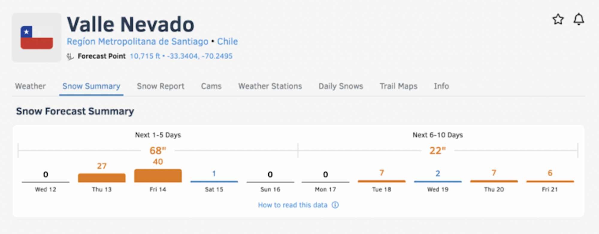
Open Snow forecast for Valle Nevado, Chile
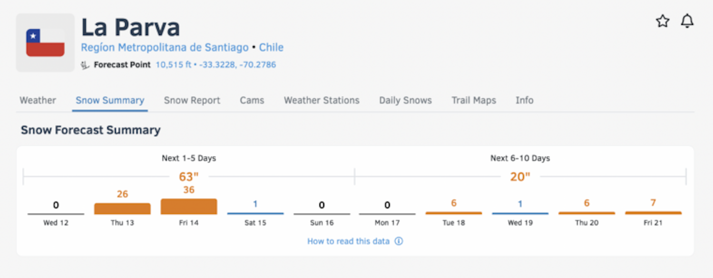

Open Snow forecast for La Parva, Chile
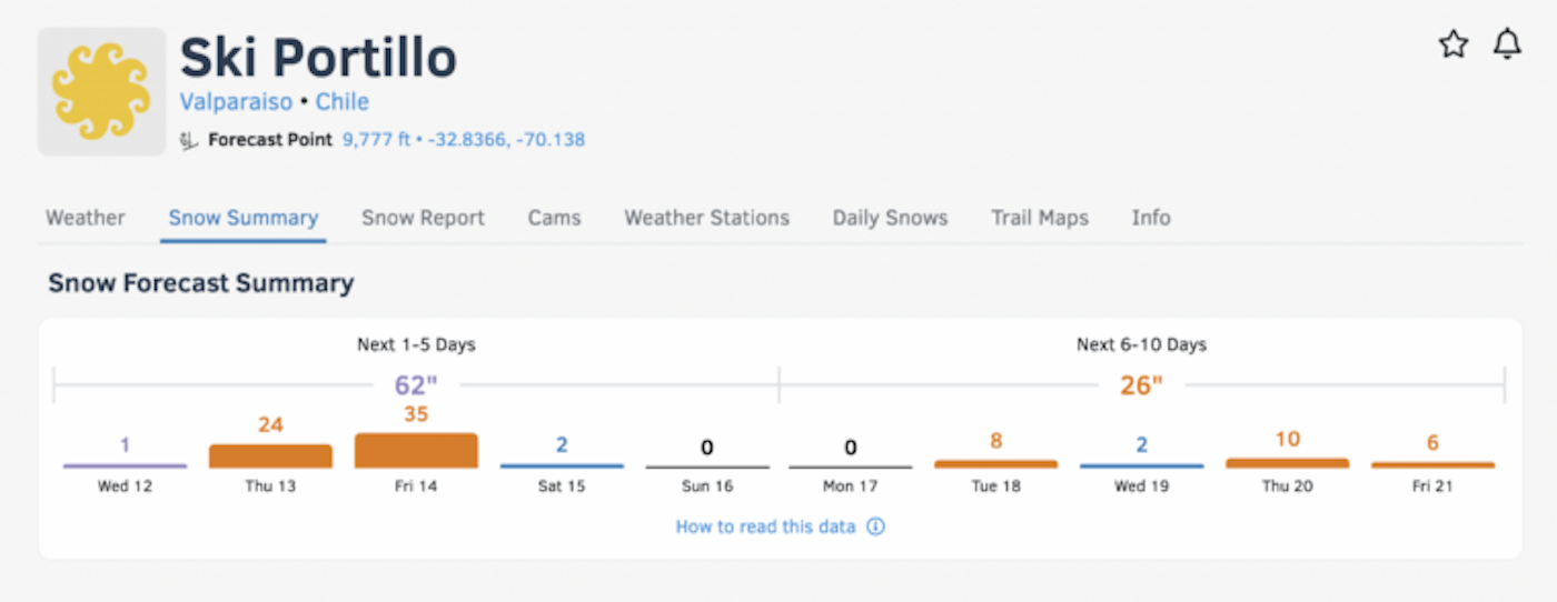
Open Snow forecast for Ski Portillo, Chile
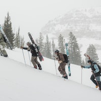
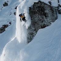
These resorts feature prominently high alpine skiing, which makes for some of the most stunning blue bird pow days on the face of the Earth. However, skiing without the cover of trees on exposed faces during heavy snowfall can be dangerous. If you’re reading this from Chile or plan on heading South in the next few days, be sure to monitor storms, especially when heading into the backcountry.

Map courtesy of Open Snow
As the storm pattern shifts slightly after this coming weekend, you can see the forecast change accordingly. A low pressure system is set to arrive Sunday evening with more snow. The warm front is expected to keep snow levels at those higher elevations at first, with a cold front descending on Monday that, “should lower snow levels below the base elevations of all resorts,” according to Stone.
Perhaps the most wild piece of this puzzle is that after this storm dissipates towards the middle of next week, another whopper is set to roll in. Storm suggests that, “A brief break is possible from Wednesday afternoon to Thursday morning as the next storm approaches from the south. It looks like temperatures will rise slightly to start the storm and then cool down with snow levels similar to the previous event… and another storm the following week. There is still no clear sign of a prolonged break in the action.” According to the experts, the faucet will remain wide open for the Andes Mountains for the foreseeable future.
If you live in the region, just arrived or are contemplating a trip South, we urge caution. Powder fever early in the season can easily cause rash decision-making. While the prospect of over-the-head turns is enough to make anyone giddy, use your best judgment when assessing conditions. Utilize that snowpack knowledge! You didn’t take those avalanche courses for nothing. We hope everyone in the Andes has a safe week with plenty of face shots.