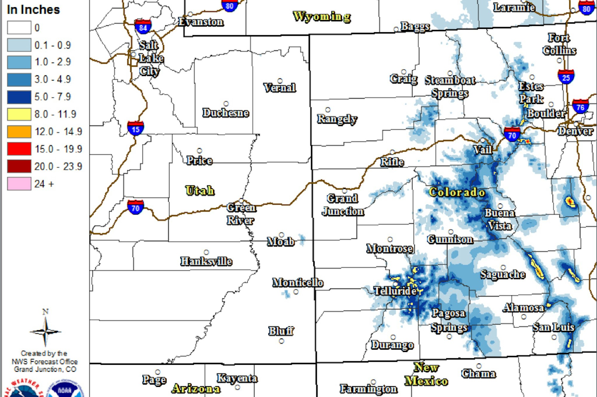

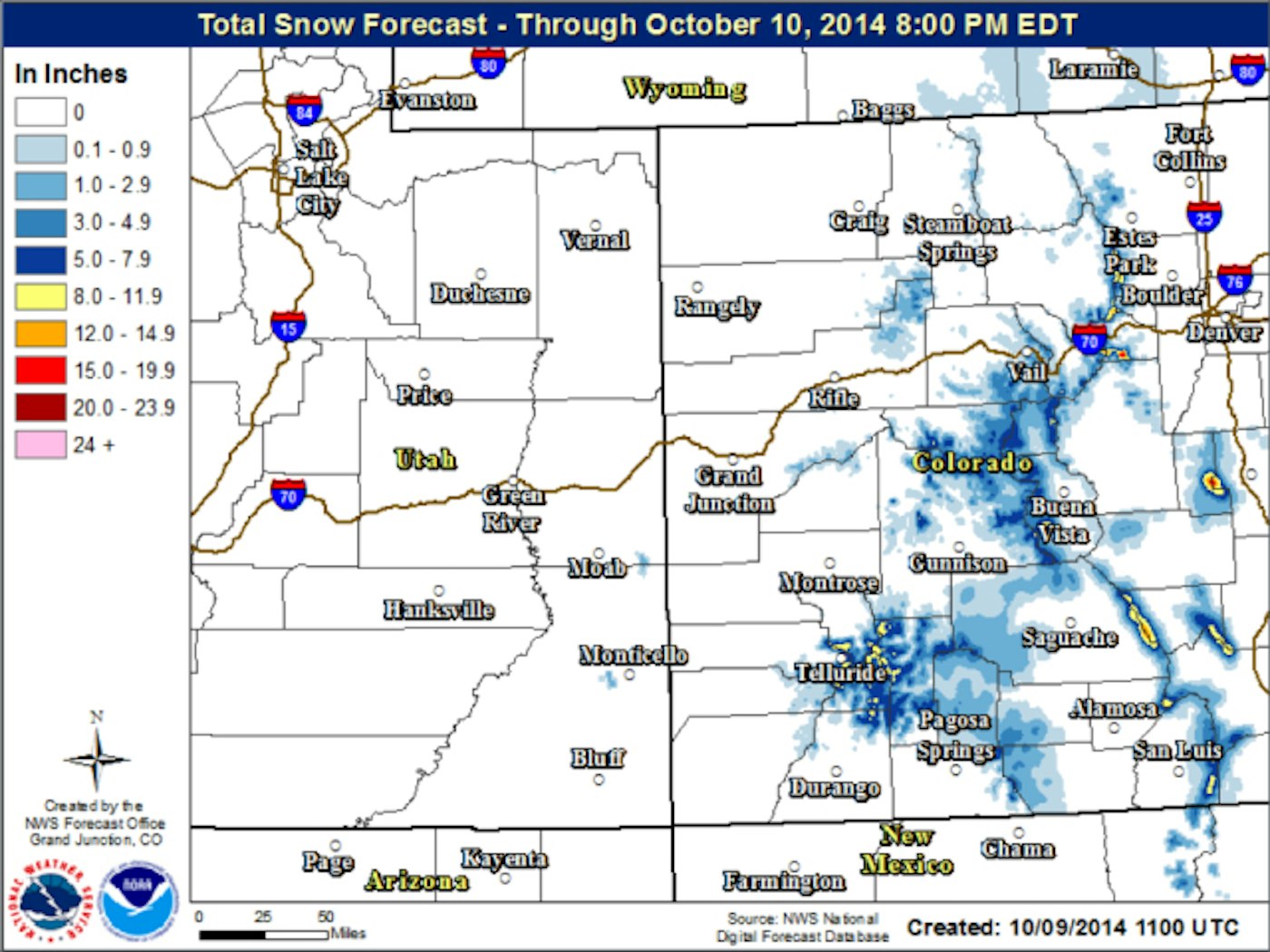
According to Joel Gratz, Colorado’s master snow forecaster and founder of opensnow.com, 10-plus inches of snow are expected to fall today through midday Friday above 10,000 feet in Colorado. Gratz writes, “for snowfall, the heaviest amounts will be on mountains over 12,000 feet (flakes will accumulate down to 10,000 feet). As for locations, since the system will generally bring winds from the south, southeast and east, the mountains favored by these directions will be Wolf Creek, Monarch, the Sangre de Cristo Range and Wet Mountains in southeast Colorado, the Collegiate Peaks near Buena Vista, and the Front Range mountains from Mt. Evans north to Berthoud Pass and the Indian Peaks.”

With areas like Copper Mountain, Loveland and Arapahoe Basin already firing up their snow guns and located in the path of the storm as mentioned above, this big snowfall could be the big push needed to open up for the season in the coming weeks. Remember, A-Basin opened on October 13 last year. Get ready, ski season is rapidly approaching.
Related: Copper Mountain anticipates opening day; officially fires up the snowguns

![[GIVEAWAY] Win a Head-to-Toe Ski Setup from IFSA](https://www.datocms-assets.com/163516/1765920344-ifsa.jpg?w=200&h=200&fit=crop)

![[GIVEAWAY] Win a Legendary Ski Trip with Icelantic's Road to the Rocks](https://www.datocms-assets.com/163516/1765233064-r2r26_freeskier_leaderboard1.jpg?auto=format&w=400&h=300&fit=crop&crop=faces,entropy)


![[GIVEAWAY] Win a Head-to-Toe Ski Setup from IFSA](https://www.datocms-assets.com/163516/1765920344-ifsa.jpg?auto=format&w=400&h=300&fit=crop&crop=faces,entropy)