Gaze up into the Sneffels Range from the base of Yankee Boy Basin, in the heart of the San Juan Mountains of southern Colorado, and your eyes will immediately be drawn to the sharp, dramatic and dominating resident 14er and namesake of the range, Mount Sneffels (14,158 feet). To any skier, the complexity of this mountain—its beauty, grandeur and scale—will pull you in, entice and attract you to try your luck at any number of its skiable lines. A successful ski descent here is enough to reward you with a lifetime of memories, a worthy accomplishment on one of Colorado’s most picturesque mountains.
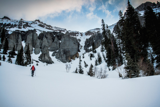
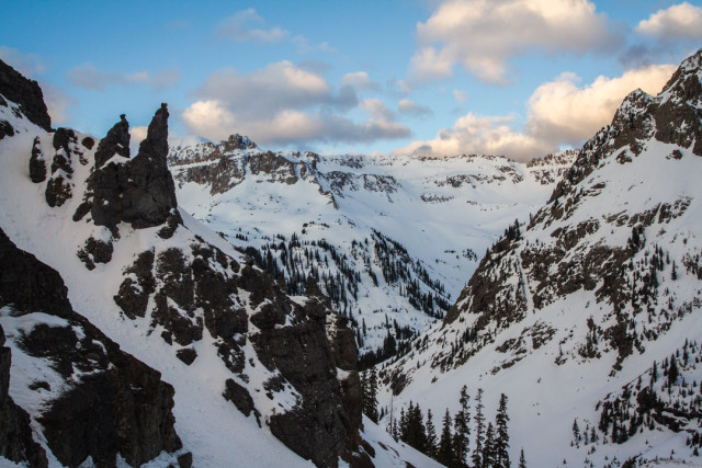
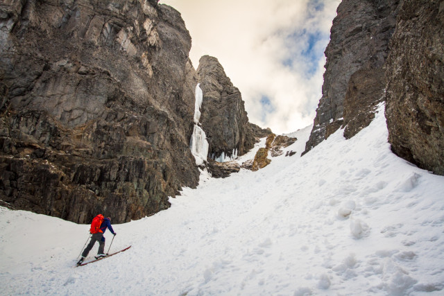
Because of the popularity and iconic nature of Mount Sneffels, it’s not unusual for skiers to head for this peak on their first trip to the area, and several weeks ago I did the same. However, it wasn’t until my ski back out of the basin that I took notice of a different mountain than the one I came to ski—one that dominated its portion of the sky line, whose impressive, broad south-by-southwest face sat prominently at the termination of the southeast portion of the range. The pinnacle of its structure, one giant cliff band that seemed to wrap 360 degrees around its broad, snow-capped summit plateau, stood out to me amongst the other mountains around us. My ski partner told me this was Potosi Peak. At the time, the mountain seemed to take the shape of an ancient Mayan pyramid more so than a skiable peak. Its structure looked to provide more opportunity for mixed-climbing than skiing. There was something of a magnetic allure, some mystery in the peak, and I vowed to return.
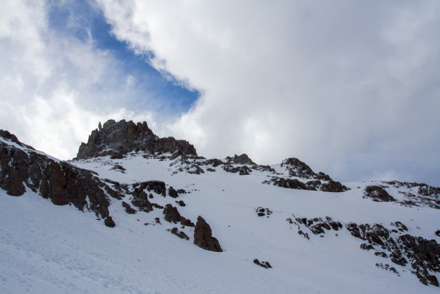
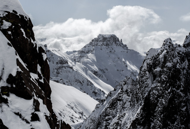
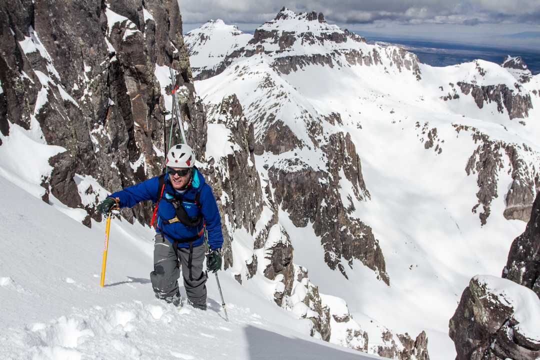
A week later, ski partner Jon Jay and I returned to Yankee Boy Basin. We were armed with more information about Potosi—ready to give the mystical giant a go. Our route would finish with a climb of the elusive North Couloir that was all but invisible from Yankee Boy Basin unless you were standing on neighboring Centennial 13er, Teakettle Mountain (13,825 feet), or in the rarely visited Weehawken Drainage. As luck would have it, a cloudy day gave way to incredible light and even better snow, and our efforts were rewarded with one of the best human-powered ski days either of us have had in Colorado.
Here’s how you can do the same:
Step 1: From the town of Ouray, Colorado, drive up Camp Bird Road to a starting elevation of 9,200 feet and the May 1 gate closure. We do not recommend driving beyond the gate until the road is officially opened, as property owners and miners may accidentally leave the gate open but are not hesitant to call local sheriffs to boot your vehicle while you’re climbing. From the closure, strap your skis to your pack, lace up your running shoes and prepare for a 3.5-mile walk up the road to the Yankee Boy Basin and Governor Basin trail junction, just a mile or so beyond the Revenue Mine. The signage is obvious—just off to the right-hand side of the road. If you happen to catch this area after May 1, drive as far as you can up the road—high-clearance, 4WD vehicles are required.
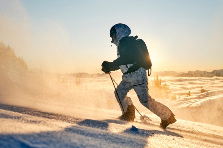
Step 2: From the Yankee Boy Basin trailhead, transition to skins and trek up the summer trail/road. Then, continue to follow the obvious cut trail. You’ll be skinning below the base of Potosi Peak but its true nature will be obstructed by your vantage point here. Continue to follow the trail for about 20 minutes, watching for a single, broad, but short spire on a peak looker’s left of Potosi called the Coffee Pot. If you’ve done your research, this geological formation will be somewhat obvious to you. Follow the ridge line down from the Coffee Pot to the looker’s right-hand side until you spot the tiny col that sits below Potosi peak; this is your path of ascension, and you must reach this spot in order to access the Weehawken Drainage and the north side of Potosi Peak.
Step 3: At about 11,200 feet, begin to veer off the obvious summer trail/road to your right. Start a gradual ascent with the Coffee Pot/Potosi col above in your mind. As you continue to ascend, keep your eyes open for an obvious gully that is bordered by large rock formations on either side; this is your gateway to the col that will give you access to the basin beyond the Coffee Pot and Potosi. Ascend via the path of least resistance, skinning, ski cramponing or cramponing through this gully and out onto the southwest face.
Continue climbing up toward the col directly above you. You’ll enter a second gully before culminating your climb with a tremendous view out into the San Juans and across Potosi’s north face. This south/southwest-facing slope gets very warm in the afternoon, so beware of rockfall in the gullies and time your ascent for perfect corn snow on your way back out. You will climb for about 1,800 to 2,000 vertical feet to an altitude of around 13,100 feet at the top of the col.
Step 4: From the top of the col, inspect the northeast-facing chute below you. You’ll see Potosi Peak to your right, which will have taken a completely different form than you’re used to seeing in photographs from higher in the basin. Its spires add to the mountain’s mystic and the North Couloir is still hidden in a deep inset of rock, just out of view. Watch out for a large cornice on the leeward side here, and take your time finding the best entrance to the northeast-facing chute below. We recommend a ski cut or two here as the slope tends to be wind-loaded. Drop in and ski about 500-600 feet into the basin below.
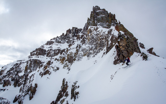
Step 5: From the bottom of the basin, peer up into the elusive North Couloir. You have about 1,200 vertical feet of steep climbing to the summit. The couloir offers a consistent 45-degree slope angle throughout, with the tight and shallow crux a quarter of the way to the top being a bit steeper. Some parts of this climb may reach 50 degrees depending on snow levels, and we highly recommend an axe and crampons for added security during this part of the climb.
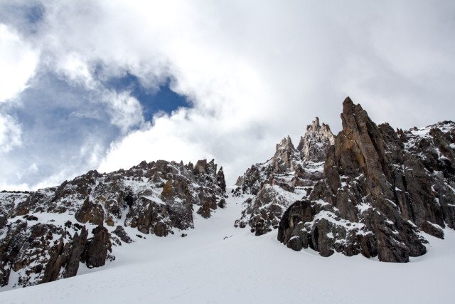
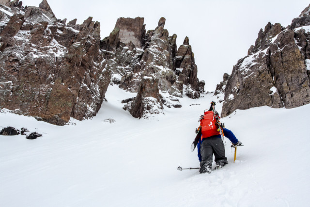
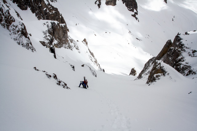
Step 6: Once you’ve reached the top of the couloir at about 13,700 feet, take a quick break and inspect the last 100 or so feet to summit. You can track out on to the northeast face, kicking very steep steps to the summit ridge, or work your way up through the rock features on the looker’s right of the couloir. Take your time here—a fall would not be enjoyable.
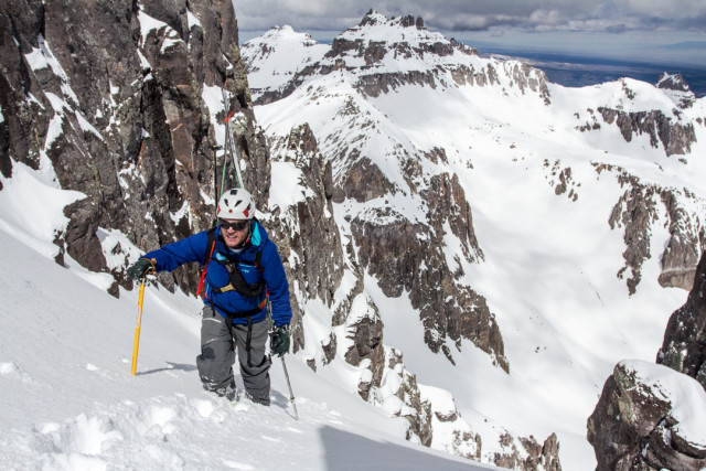
Step 7: Once through the short, but steep section, enjoy a leisurely walk up the ridge and on to the summit plateau. Take in 360-degree views.
Step 8: Click into your skis and descend parallel to your bootpack back down to the top of the North Couloir. As your turns roll over and culminate into the top of the couloir, be sure to take your time—this is a no-fall-zone.
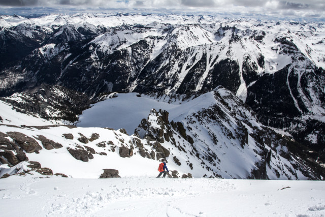
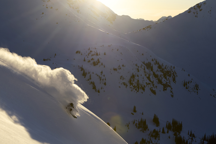
Step 9: Ski the couloir. There are several safe zones on the skier’s right and again on the skier’s left. Take your time through the top, which can be thin depending on snow levels. The couloir broadens down toward the bottom, culminating in a beautiful, wide-open apron of about 40-degree turns into the basin below. Don’t be skimpy; if the snow’s good, take this line as far as you want.

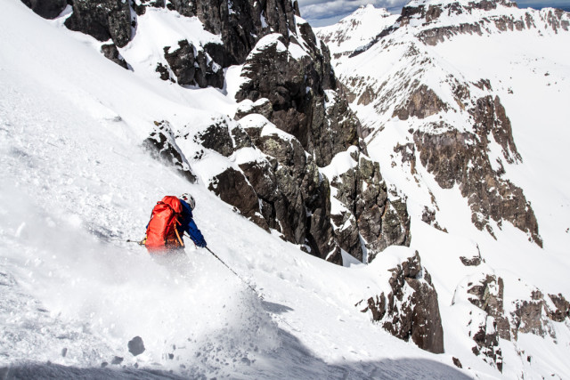
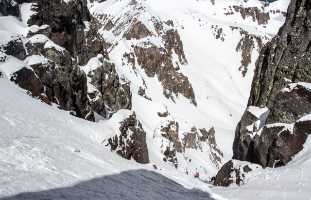
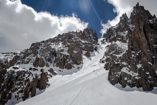
Step 10: Ascend back to the Coffee Pot/Potosi col—roughly 500-600 feet of climbing depending on how deep you take your descent from the North Couloir. Use caution here, as the northeast-facing climb heats up during the late morning and you’ll be climbing beneath a cornice. If the day is going to be exceptionally warm, plan accordingly for an early start or research an alternative exit through the Weehawken Drainage.
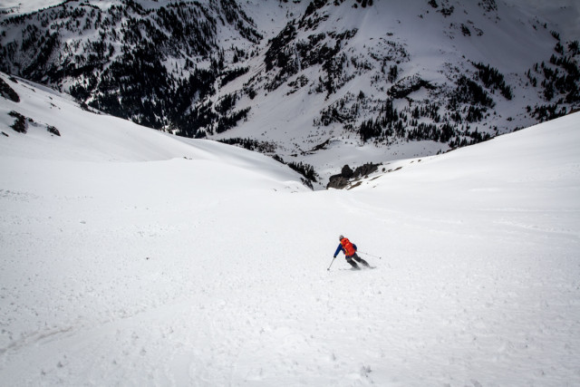
Step 11: From the top of the col, retrace your original route of ascent, enjoying about 1,800-2,000 feet of corn snow back down to the Yankee Boy Basin summer trail/road. Watch for rockfall in the gullies, as the rock has a tendency to get hot here. Continue your descent to the junction of Governor/Yankee Boy Basin summer trails.
Step 12: Transition back to your sneakers and prepare for your 3.5-mile walk back to the truck at the May 1 gate. Watch for icefall onto the road on your way out, and don’t linger in places that you obviously shouldn’t.
Stats:
Total Vertical Climb: 5,800 feet
Total Miles Round Trip: 12.5 miles
Total Time Round Trip: 10 hours
Side Note: Potosi Peak is now private property. Contact owner, Mickey Tiner, for permission to access the mountain.
