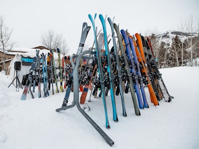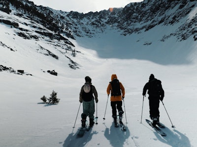
In this week’s weather, the Rocky Mountains will get hit with snow storms, with areas in Colorado, Wyoming, Montana and Utah all benefiting from an influx of the white stuff. Northeasterners should scramble to enjoy some of the new snow from Winter Storm Hercules, before temperatures plummet to unbearable numbers, while folks in the Midwest will enjoy a bit of new snow, followed by record low temperatures starting next week. It will remain dry for much of the West Coast, with the exception of Crystal Mountain, Washington, well into next week.
Colorado
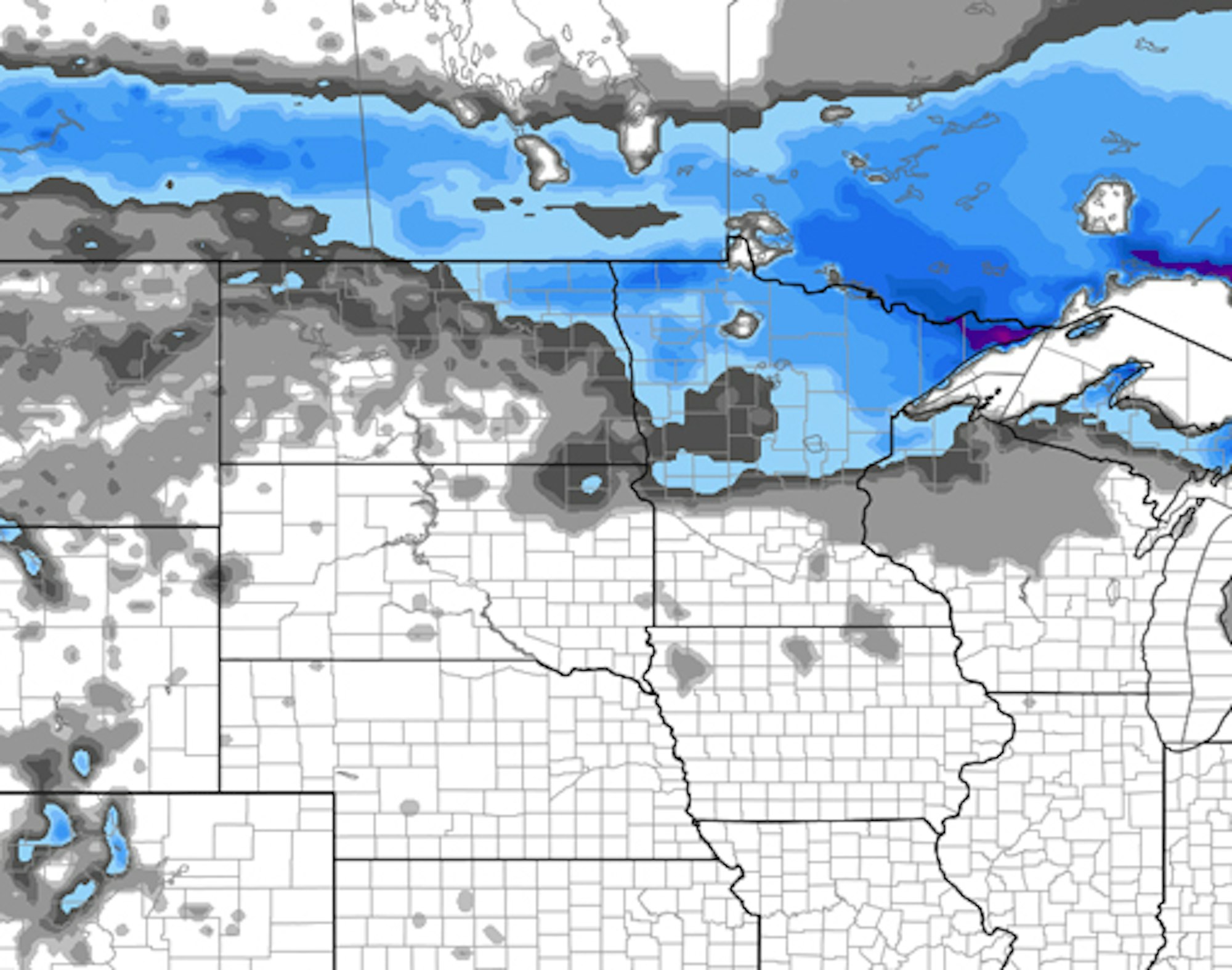
It appears a nice, January snow storm is moving into central and northern Colorado on Friday night. The storm should kick into gear up north, dumping snow on Steamboat, and then will likely move south towards Interstate 70 as the day begins on Saturday. When it’s all said and done, later that same day, resorts like Winter Park, Loveland, Vail and Copper could all receive anywhere from five to 12 inches of snow, depending on location (and luck). Saturday night and Sunday could see some flurries, while Monday and Tuesday will be mostly dry, with another chance of new snow on Wednesday.
For daily Colorado powder forecasts from OpenSnow founder Joel Gratz, click here.
Weather map courtesy of OpenSnow.com
The Northeast
Winter Storm Hercules just dumped a whole lot of snow on the Northeast. Bradford, Massachusetts was graced with 18 inches of new snow, while Mount Snow, Vermont received 15 inches. With a fresh blanket of deep snow covering most of the northeastern ski areas, the actual shredding this weekend should be prime. However, the east will be buried in bitter cold temperatures across the region, so be sure to bundle up when getting after the fresh. Looking forward, there’s a chance of a rain event next week, but for now, enjoy the new pow and keep praying to the snow gods.
Brian Clark heads the New England snow forecasts with New England Daily Snow.
The Northern Rockies
A storm is moving into the Northern Rockies on Friday, and most ski areas stand a chance at some solid snow accumulation. For Montana: Big Sky, Bridger Bowl, Montana Snowbowl and Whitefish are all expecting 1 to 3 inches of snow during the day on Friday, and the snow is set to stay all the way through Saturday, totaling as much as 8 to 10 inches in some spots.
Idaho’s best shot at new snowfall will come on Friday and Friday night, as 3 to 7 inches could fall at Bald Mountain and Lookout Pass, while most other areas stand a chance at an inch or so of accumulation.
Wyoming is set to add to its snow totals going into this weekend. Grand Targhee could get hit with 4 to 8 inches of snow through Saturday, while Jackson Hole could have up to 7 inches when the snow halts on Saturday night.
Utah
A weak storm is set to move into Utah on Friday night, as a cold front is beginning to move its way into the northern part of the state. Although the snow totals won’t be massive, areas like Alta, Brighton, Canyons, Deer Valley, Park City and Snowbird could all see a dusting to 3 or 4 inches of snow by Saturday afternoon. The next bet for new snow will come on Tuesday night.
Stay up to date on weather in the Beehive State thanks to Evan Thayer.
Pacific Northwest
The next couple of days look to be fairly dry for the Pacific Northwest. For Washington, there’s a chance of a dusting on Friday at Crystal Mountain, Mt. Baker, Stevens Pass and Alpental, but the next chance for any significant snowfall will come on Tuesday night, where Crystal Mountain is projected to receive anywhere from 3 to 7 inches of snow.
The prospects look fairly similar for Oregon, a dry couple of days, with a shot for some Tuesday snow at Spout Springs, and Anthony Lakes on Tuesday.
Click here for the complete Pacific Northwest forecast.
The Sierra Nevada
Unfortuntaley for you Californians, the forecast is a bit dry, at least for this weekend. The temperatures will stay in the mid-40s from now through Monday, but after that a couple of systems will move into the area, with the strongest coming next weekend. Stay tuned for more from the Sierra Nevada: the season is sure to pick up soon.
Bryan Allegretto provides daily snow forecasts for California, here.
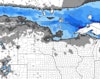
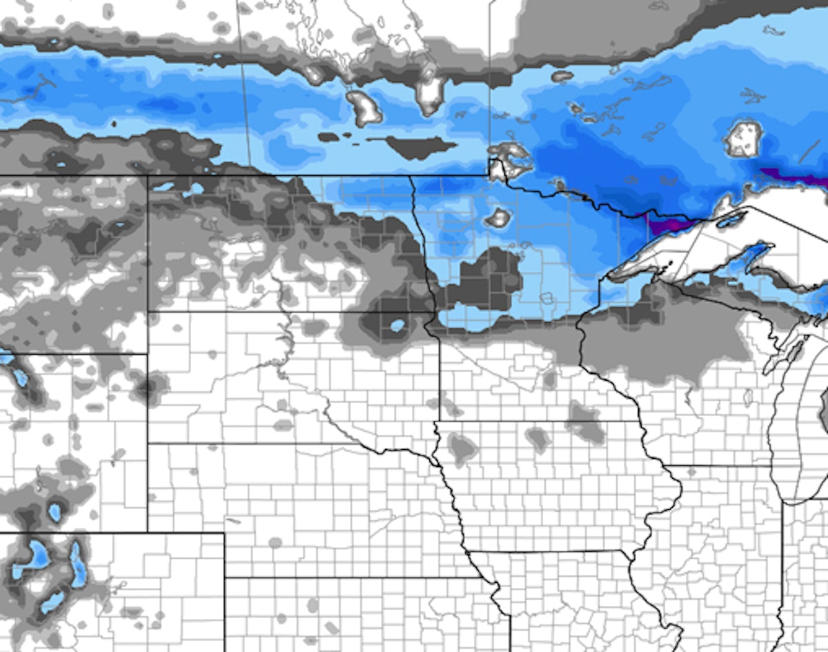
Snowfall forecast for the Upper Midwest, courtesy of OpenSnow.com
The Midwest
Midwesterners should get their fix of new snow in Michigan and Minnesota through Saturday, where areas like Lutsen Mountain, Giants Ridge, and Buena Vista could see 4 to 8 inches. Michigan will see snow throughout the weekend, starting on Saturday morning. Unfortunately, temperatures are supposed to plummet, OpenSnow Meteorologist Andrew Murray says wind chill values could be at -50 degrees in Minnesota on Monday morning. Get after the early snow, stay warm, and for those braving the chilly weather for some solid powder turns, good luck.
For more from the Midwest, follow OpenSnow’s Andrew Murray.
Be in the know when it comes to chasing powder this season. Sign up for our weekly Powder Alert newsletter.

![[GIVEAWAY] Win a Head-to-Toe Ski Setup from IFSA](https://www.datocms-assets.com/163516/1765920344-ifsa.jpg?w=200&h=200&fit=crop)

![[GIVEAWAY] Win a Legendary Ski Trip with Icelantic's Road to the Rocks](https://www.datocms-assets.com/163516/1765233064-r2r26_freeskier_leaderboard1.jpg?auto=format&w=400&h=300&fit=crop&crop=faces,entropy)


![[GIVEAWAY] Win a Head-to-Toe Ski Setup from IFSA](https://www.datocms-assets.com/163516/1765920344-ifsa.jpg?auto=format&w=400&h=300&fit=crop&crop=faces,entropy)