Featured Image: Gabe Rovick
The United States National Oceanic and Atmospheric Administration (NOAA), one of the most trusted meteorology sources in the world, recently released their winter 2024/25 predictions. Read on for the official report from NOAA, descriptions, and our takeaways for where YOU can score blower pow days this winter.
It’s important to note that while these predictions are based on detailed scientific data, backed by months of pattern analysis and years of research, they are by no means precise predictions for specific states or areas. However, they can offer a real look at what general regions may look like this winter. Plus, they’re fun to go through so what’s the harm in fantasizing about a few deep turns this winter? No judgment here.
Before we explore the current predictions, let’s examine what some of the complicated terms mean.
NOAA makes upcoming winter weather predictions for North America based on patterns and data readings in the Pacific Ocean. This is called ENSO (El Niño / Southern Oscillation) patterns. ENSO refers to the general climate patterns in the Pacific Ocean and does not indicate an El Niño cycle, despite the name. Yes, it’s confusing. From this pattern, they can measure temperature anomalies that are developing. These predicted cycles are indicated by terms you’ve likely heard before; El Niño and La Niña.
“El Niño and La Niña represent opposite extremes in the El Niño/Southern Oscillation (ENSO). The ENSO cycle refers to the coherent and sometimes very strong year-to-year variations in sea-surface temperatures, rainfall, surface air pressure, and atmospheric circulation that occur across the equatorial Pacific Ocean” – NOAA
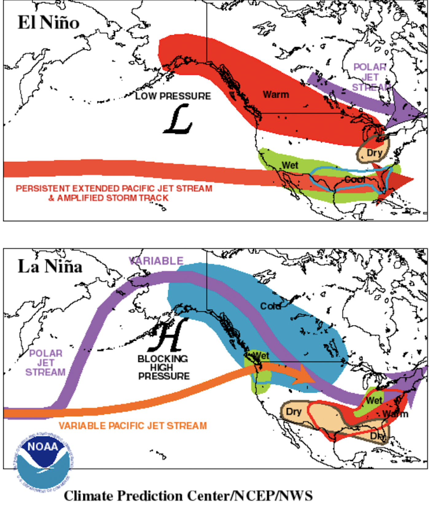

El Niño (top visual) is characterized by warmer than normal tropical Pacific ocean surface temperatures.
Typically lasts around 9-12 months and is more frequent, according to NOAA.
La Niña (bottom visual) is characterized by cooler than normal tropical Pacific ocean surface temperatures.
Typically lasts 1-3 years. According to NOAA, durations of either can vary greatly, even by a matter of years.
NOAA Has Initiated a La Niña Watch
NOAA is reading a neutral ENSO pattern with ocean temperatures throughout the Pacific showing a blend of above and below average. But current cooling shows La Niña developing. The Administration initiated a La Niña Watch, which is, “Issued when conditions are favorable for the development… within the next six months.”
La Niña outcomes are typically rare compared to El Niño, and they can bring copious amounts of snow the Pacific Northwest (PNW) and North Western Rocky Mountain regions of the U.S. Consider the winter of 1998/99. The legendary Mt. Baker Ski Area in Washington set the record for most snowfall at a ski resort in a single season with 1,140 inches (95 FEET) of snow. That winter was, you guessed it, a La Niña winter.
“ENSO-neutral is expected to continue for the next several months, with La Niña favored to emerge during August-October (70% chance) and persist into the Northern Hemisphere winter 2024-25 (79% chance during November-January).” – NOAA

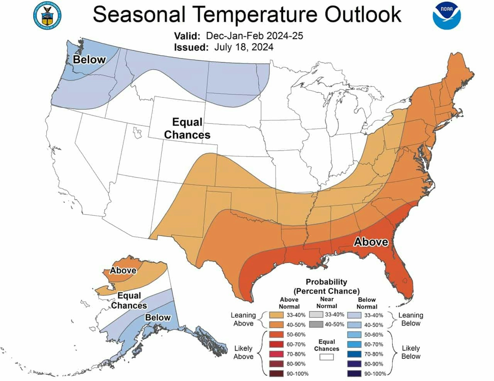
PHOTO: Courtesy of NOAA
If you’re a PNW pow chaser in decade-old snow pants or a Florida sun seeker who looks like a wrinkled basketball, you’ll be happy with the temperature outlooks. The Southeastern U.S. is looking at above-average temps while the Northwestern States, as well as Southeastern Alaska, have a high probability (40 – 50%) of below normal temps.
This outlook does not pertain directly to snowfall, and it’s only valid through February. Combining it with the Precipitation Outlook (below) gives us a better idea of how the winter is shaping up.

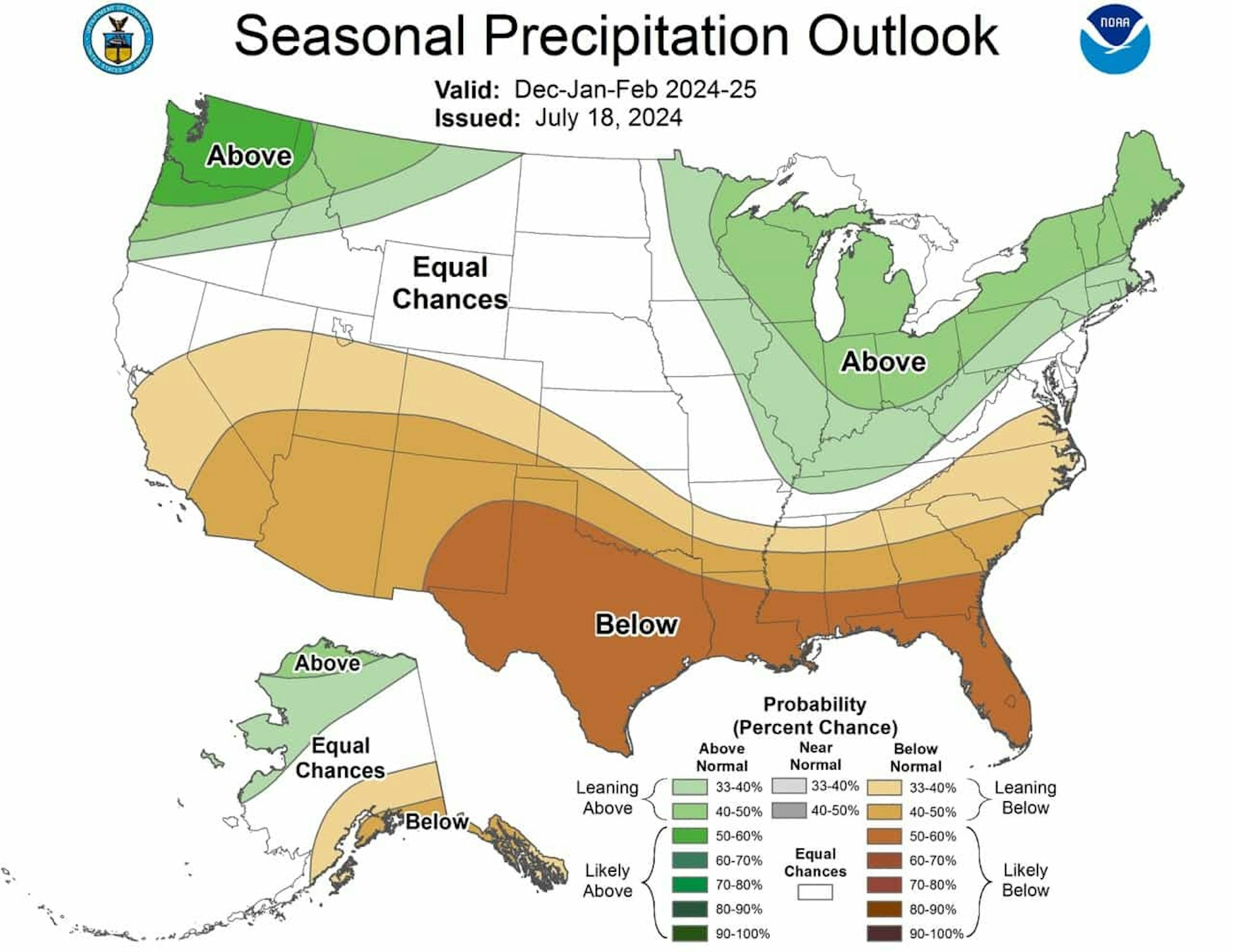
PHOTO: Courtesy of NOAA
The precipitation outlook favors similar areas, with a few key differences. Areas from Washington through Southeast Montana are slated to see increased precipitation, as well as the upper Northeast States. Get the fat planks out Donny, you might have yourself some mint days at Sunday Rivah.
Notice that while Southeast Alaska is expected to receive below-average temperatures, they also have a 40% – 50% chance of below-normal precipitation. Of course, that area gets unfathomable amounts of snow per normal so our friends in the Chugach Range and beyond may well still be in for plenty of big storms.
What the Hell Does This Mean?
It’s a good question. These long-term forecasts are never fully accurate. But, like anything in life, they hold bits of the truth and it’s our job to pull those out.
Based on the evidence, it seems very likely that the interior mountains of Washington and possibly Oregon will have a terrifically snow year. We already pointed out the supporting data from Mt. Baker’s record-setting 1998/99 winter and the similar patterns that are in play now. Northern Idaho and Montana also look positioned to receive plenty of cold smoke pow. Of course, while we are focusing on The United States, we’d be remiss if we didn’t mention British Columbia and the Canadian Rockies. La Niña can favor our Western dwelling, Tim Hortons-loving friends in the North.
On the other side of the country, Maine, Vermont and New Hampshire seem to be on track for a snowy winter. We’re always pulling for more East Coast pow days, but it is a bit of a toss-up with the area looking at above-normal precipitation AND temperature projections, so keep that in mind.
Can you track storms based on ocean temperatures from miles and miles away? Yes, you can! Check out the Powder Buoy for more evidence of this scientific wonder. But when it comes to months in advance, the projections get a little more sketchy. Don’t bet the farm on pow for everyone, but NOAA does give La Niña a 79% chance at persisting from November to January. We’ll take those odds any day of the week.
We’ll be sure to update you as NOAA releases more detailed reports closer to the winter. Until then, keep up those prayers to Ullr and hopefully this information does you well as we all begin to plan that upcoming great pow-fueled excursion.
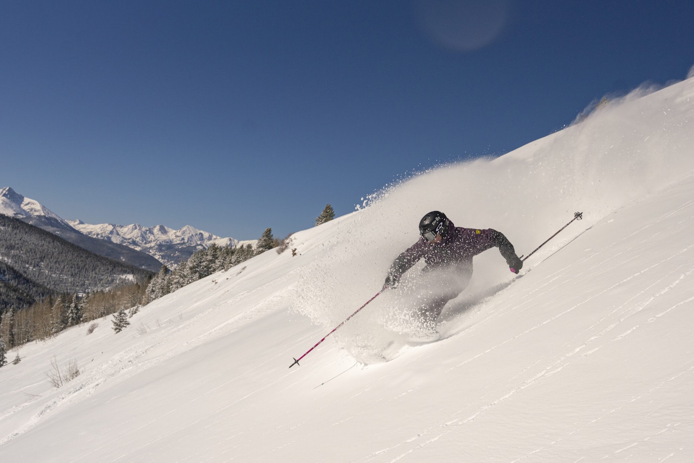
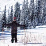
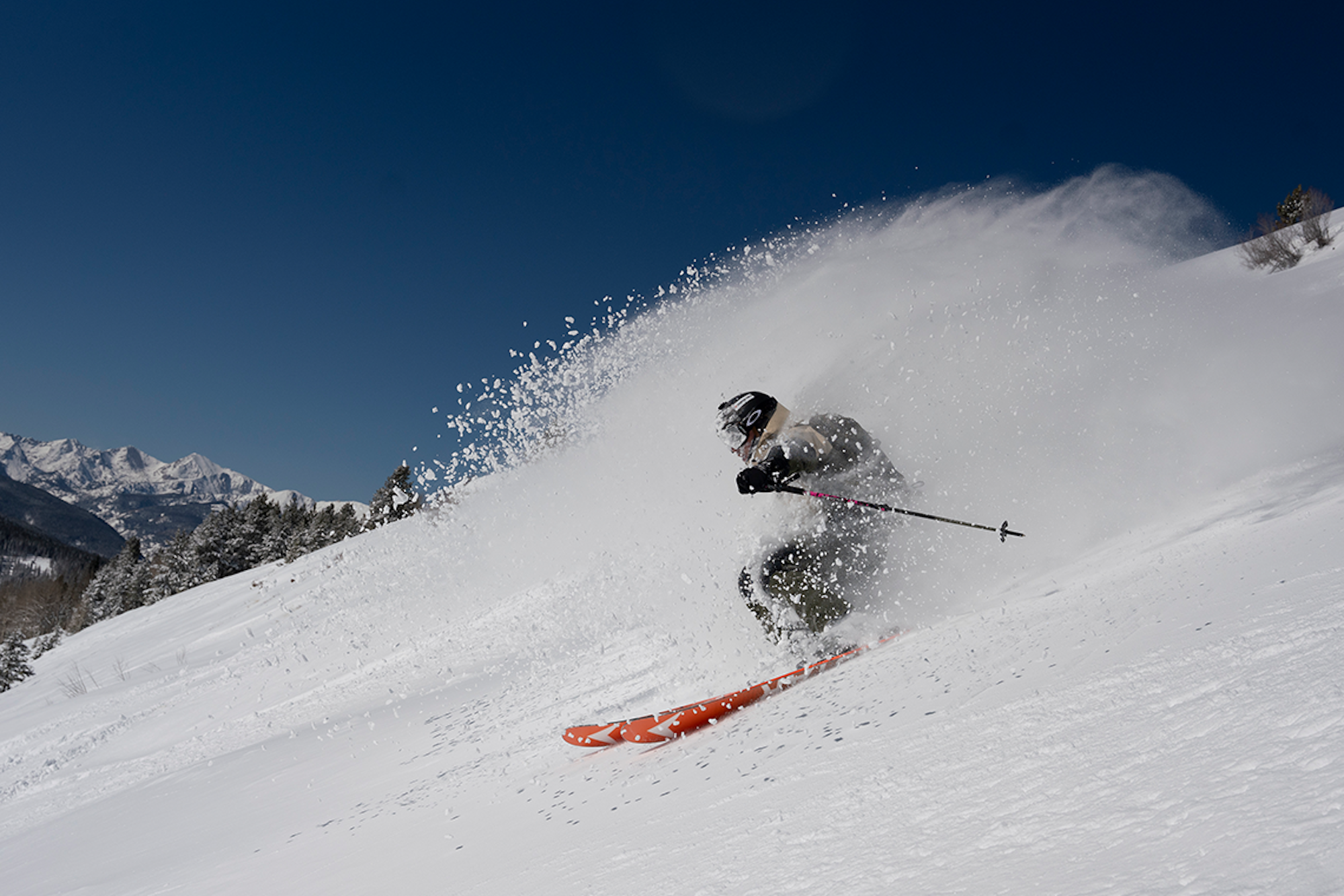
PHOTO: Gabe Rovick | SKIER: FREESKIER Publisher Damian Quigley
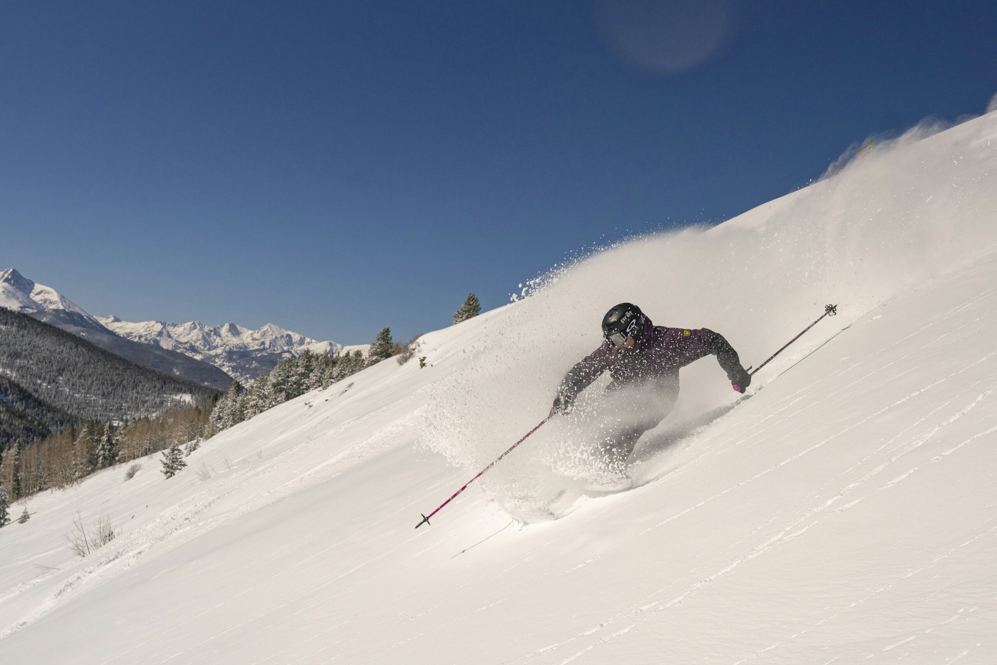
Hopefully we’re in for more days like this one!
PHOTO: Gabe Rovick | SKIER: FREESKIER Publisher Damian Quigley
Full NOAA Summary:
Currently, El Niño Southern Oscillation (ENSO) conditions are neutral with
above average sea surface temperatures (SSTs) in the west-central Pacific
Ocean, near average SSTs in the east-central Pacific Ocean, and below average
SSTs in the far eastern Pacific Ocean. A La Niña watch is currently in effect
and is favored to develop during August-September-October (ASO; 70% chance) and
persist into the Northern Hemisphere winter 2024-25 (79% chance) during
November-December-January (NDJ). As summer wanes and winter approaches, the
overall temperature and precipitation patterns across the contiguous U.S.
(CONUS) and Alaska are expected to transition to those associated with typical
La Niña impacts. For the remainder of summer and early fall 2024 and again late
spring and summer 2025, the overall outlooks resemble long-term decadal trends .

The ASO 2024 Temperature Outlook favors above normal temperatures for much of
the contiguous United States (CONUS), with the strongest probabilities reaching
60 to 70% over parts of the Interior West and New England. Above normal
temperature probabilities of 50 to 60% are forecast over the Gulf and Southeast
Coasts, including Florida. In contrast, equal-chances (EC) of above-, near-, or
below-normal temperatures are favored over the West Coast of CONUS and portions
of the Northern Plains. Below normal temperatures are indicated over
southwestern Alaska, transitioning to above normal over the northeast part of
the state.

Below normal precipitation is favored over parts of the western and central
CONUS in ASO 2024, except over the West Coast where EC is favored. Above normal
precipitation is forecast for southeastern Texas, the Gulf States, and along
the Eastern Seaboard into New England with the highest probabilities (50 to
60%) centered over Florida. Above normal precipitation is also indicated over
western Alaska. For the remaining areas of CONUS, EC is forecast. 

