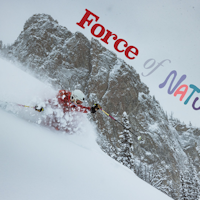
On August 4, 2016, the White River National Forest (WRNF) released its Final Environmental Impact Statement and Draft Record of Decision for Arapahoe Basin’s (A-Basin) proposed projects within its Special Use Permit (SUP) boundary. The projects derive from A-Basin’s 2012 Master Development Plan (MDP), of which the WRNF has largely given the OK to. If the ski area, located in Summit County, CO, receives final approval in the coming months, its skiable terrain will increase from 958 acres to 1,296, as former backcountry territories the Beavers and Steep Gullies will be annexed within the ski area boundary.
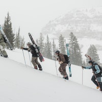
The Beavers and Steep Gullies zones are especially popular, as both are easily accessed via the Pallavicini Chair—one of Colorado’s hallowed steep skiing lifts—as well as the Lewanee triple, and feature steep, rocky, north-facing chutes, cliffs, open bowls and plummeting glades. The new terrain would include the implementation of a chairlift that will serve the Beavers zone. The Steep Gullies terrain will be “hike-back” terrain, where skiers will need to backtrack to the base of the Pallavicini (or Pali, as it’s known) chairlift to gain subsequent uphill access.
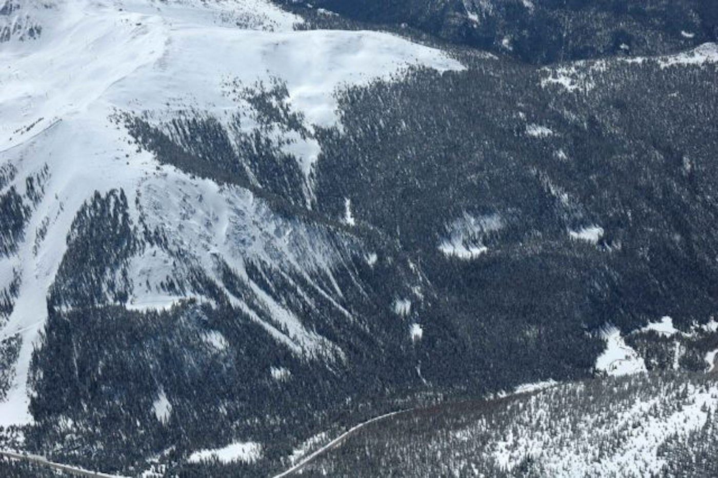
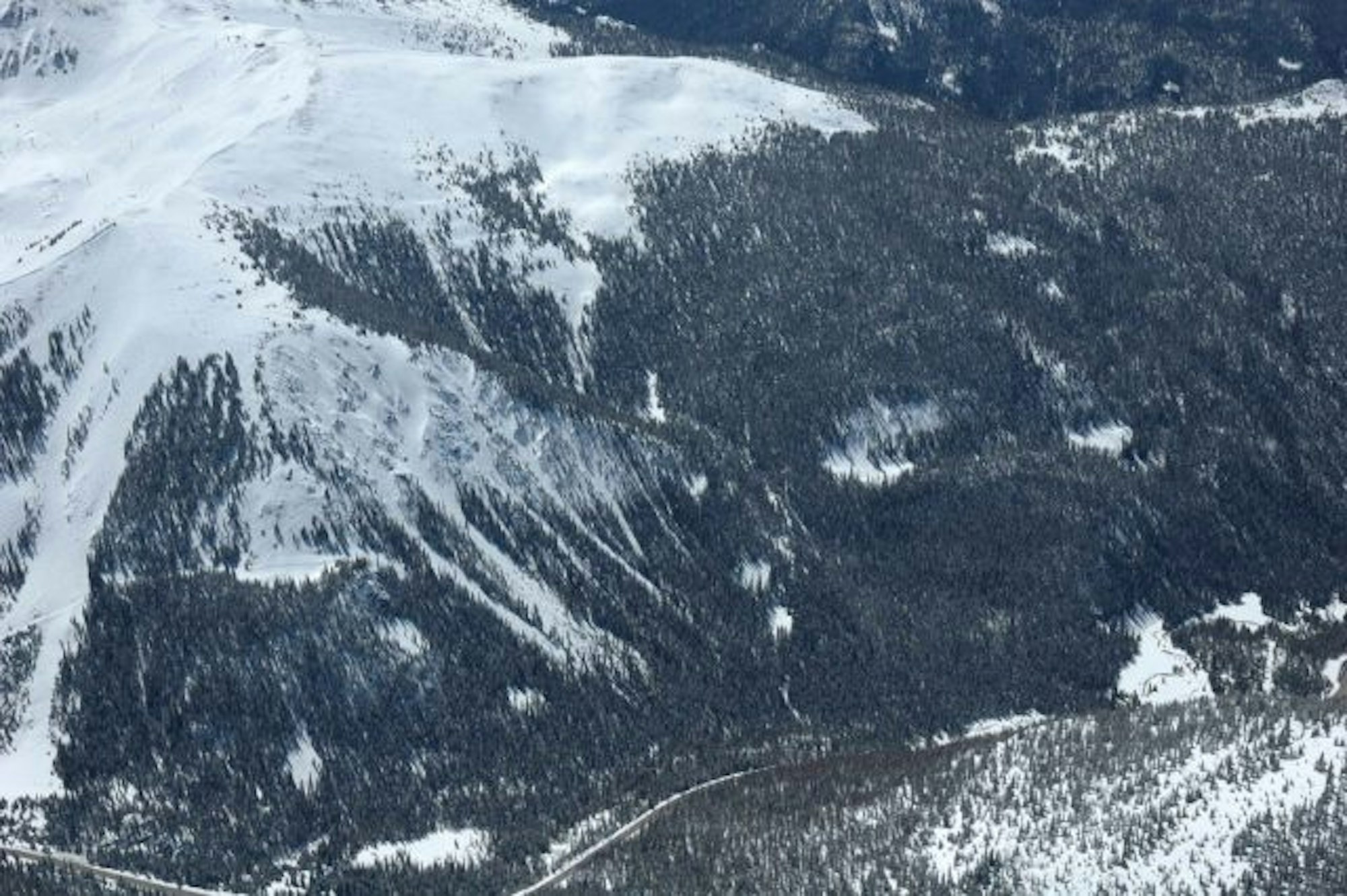
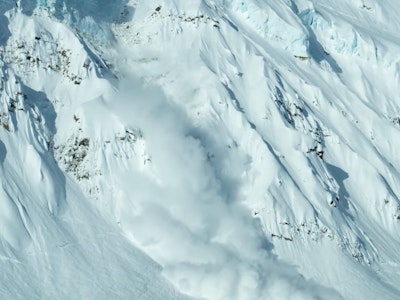
A bird’s eye view of the Beavers and Steep Gullies terrain. Photo: Hal Hartman for Arapahoe Basin Ski Area
“I believe, and the analysis prepared confirms, that incorporating the Beavers into A-Basin’s operational boundary (and, therefore, performing snow safety and ski patrol operations) will greatly increase skier safety in this area,” WRNF Forest Supervisor Scott Fitzwilliams outlined in the written report.
With the increased skier traffic in Colorado (there were 7.4 million total skier visits at Colorado Ski Country member resorts in 2015-16, a new record) and Summit County specifically, the expansion would set up the ski area to adapt to the influx of traffic.
“When we talk about expansion projects, we talk about preparing the Basin to meet current and future demands for skiing,” explains A-Basin’s Chief Operating Officer Alan Henceroth. “The addition of the Beavers terrain sets us up well to accommodate future demand for terrain and to improve the guest experience. The terrain in the Beavers and Steep Gullies is also prone to avalanches, and we believe that by servicing this terrain with an avalanche mitigation plan, we can better serve all users of it.”
Now that the WRNF has given a favorable review, the proposed projects are up for public objection for the next 45 days.
In addition to the new terrain, A-Basin’s plan includes the construction of one new surface lift which will transport skiers from the top of the Lenawee Mountain lift to the summit of the Zuma chairlift for better access to Montezuma Bowl; the replacement of the Pallavicini and Molly Hogan lifts; and the removal of the Norway chairlift. There will also be a Canopy Tour implemented to accommodate multi-season recreation.
“These projects are all about improving the overall guest experience. Our goal is to make the ‘stuff’ of A-Basin work better without changing the vibe,” explains Adrienne Saia Isaac, A-Basin’s communications manager. “Lifts are like cars—you have to replace the parts after a certain amount of time. That’s what we’re doing with Pali. We’ll be replacing an old fixed grip double chair with a new fixed grip double chair. The carrying capacity will be similar to what we have now.”
There may be pushback from the skiing community that frequents A-Basin’s lift-accessed backcountry, as the incorporation of the Beavers and Steep Gullies into the ski area boundary takes many coveted out-of-bounds lines and makes them available for resort skiers.
“Throughout the public involvement process I have listened to the concerns of several members of the public that value the existing characteristics of the Steep Gullies and the Beavers terrain, in general,” said Fitzwilliams. “I acknowledge that my decision may change your impression of A-Basin and the experiences that you may have within this area. However, I have also heard from users of this terrain that have explained the reality of this area, which is that the vast majority of people using this area ride the chairlift, ski the terrain and return to the ski area by the Pallavicini chairlift.”

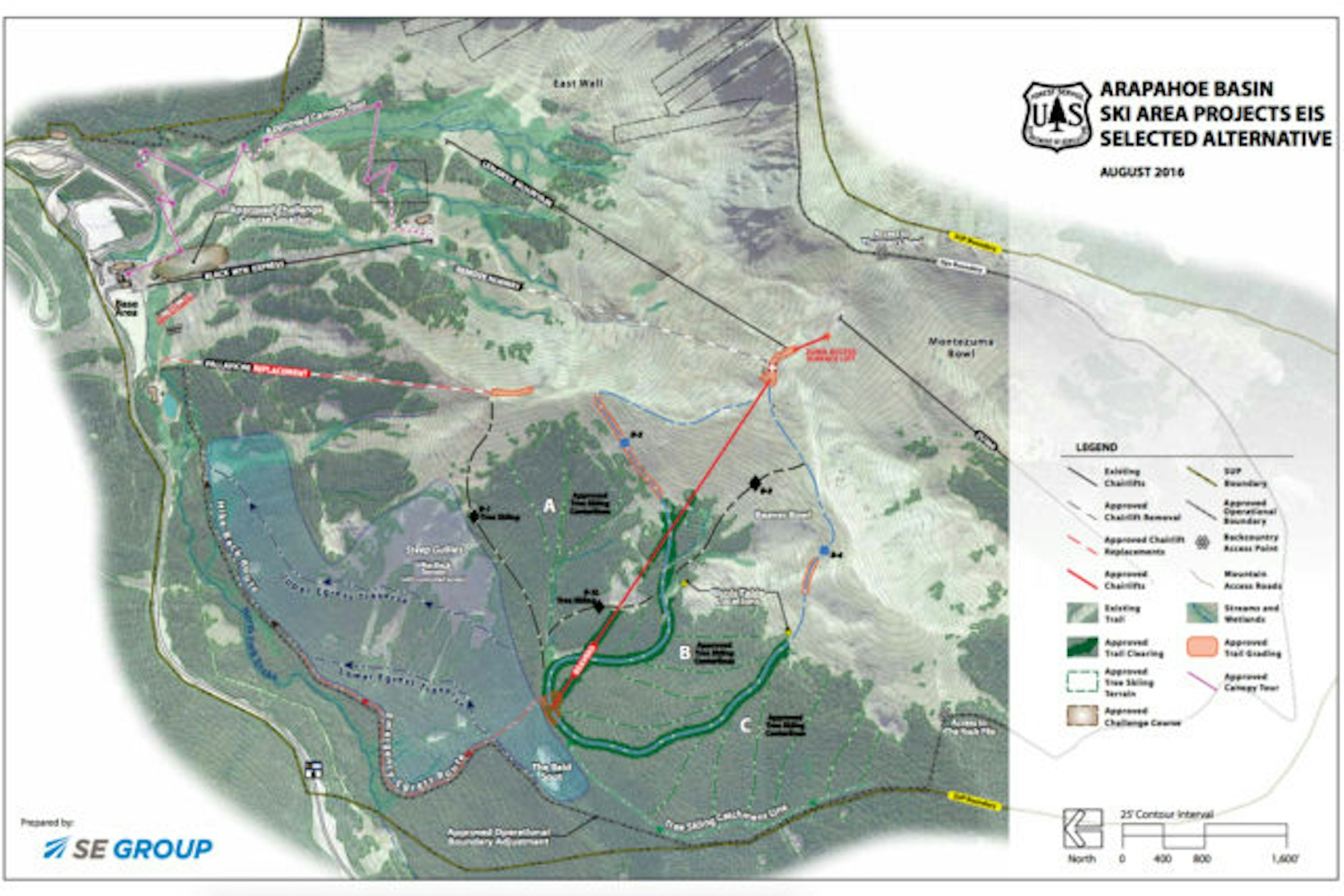
Arapahoe Basin Ski Area Projects EIS Selected Alternative. Image courtesy of the White River National Forest
He went on to add that, while the Beavers and Steep Gullies will no longer be considered backcountry terrain, Summit County’s wilderness skiing opportunities are still ample. Although the three Forest Service-designated backcountry access gates to the Beavers will be removed, the existing access point to Thurman’s Bowl will remain, and an additional one will be placed at the Rock Pile near the ski area’s new western boundary.
On top of concerns from backcountry skiers, there is an environmental aspect to the expansion, as the Draft Record of Decision outlines that approximately 63 acres of Canada Lynx habitat will be affected. However, the WRNF and A-Basin are committed to working together “to educate the public on the importance of smart, common sense dispersed and developed recreation and the importance of preserving and improving wildlife habitat in key areas,” in order to mitigate impact.
As far as a timeline, if the ski area receives final approval, Henceroth is optimistic that the new terrain could be open by the 2018-19 season.
To read the full Final Environmental Impact Statement and Draft Record of Decision, click here.