
Most of the country will finish the month of February with a bang, resulting in powder days for many of you. The Pacific Northwest, which has been getting hammered with snow, will have a chance at more accumulation later in the week. Utah and Colorado will continue their snowy streaks this weekend, too, as powder days are projected for Friday and Sunday. Lake Tahoe will get back into its groove, as 6 to 12 inches of new snow is projected to fall above 6,500 feet by Thursday morning. Cold air will return to the Northeast this week, and northern resorts should see significant snowfall after Wednesday. Read below to see where the snow will fall in your region.
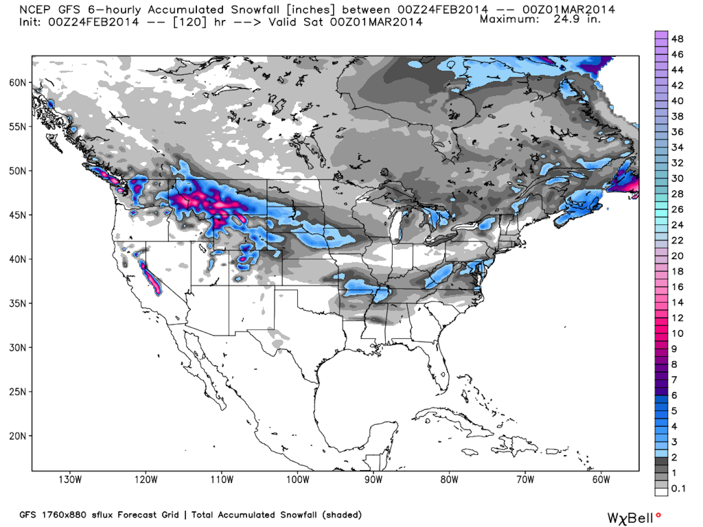

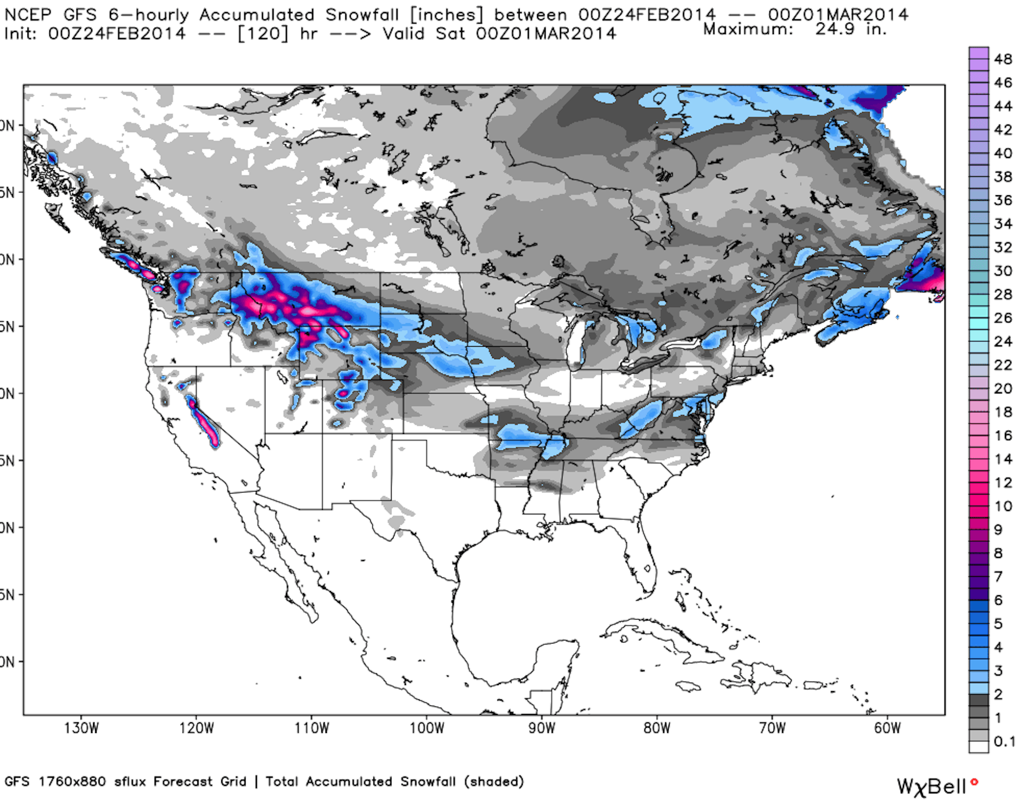
This week’s snow accumulation map, courtesy of OpenSnow.com.
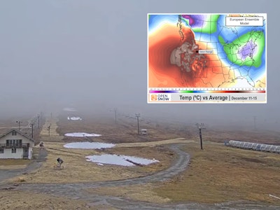
The Sierra Nevada…
Snow will once again return to California, and in a big way. Thursday, Friday and Saturday should all be powder days for most of the state. Snow will move into the Sierra on Wednesday, dropping huge snow totals above 7,000 feet in elevation, resulting in 17 to 36 inches at Squaw Valley/Alpine Meadows, 18 to 33 inches for Kirkwood and 20 to 36 inches at Sugar Bowl through Saturday.
Image not available
Radar: a system heads towards the west coast.
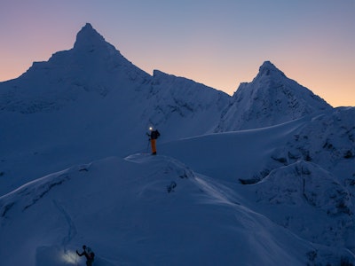
The Northern Rockies…
Conditions in the Northern Rockies are all time right now. Just ask Freeskier’s managing editor, Damian Quigley:
Snow will fall throughout the day on Tuesday in Wyoming, with the next storm moving in on Thursday. Jackson Hole is projected to receive 11 to 22 inches by Saturday night, while Grand Targhee will be in the 8 to 17 inch range.
In Montana, the white stuff will start dropping on Thursday and won’t cease until Saturday night. Bridger Bowl is expecting 7 to 17 inches of snow in that time period, Big Sky is projected to see 6 to 14 inches and Montana Snowbowl should see 4 to 12 inches.
Idaho‘s big winners in the snowfall category will be Pomerelle and Magic Mountain. Pomerelle, located in the southern portion of the state, is projected to see 4 to 9 inches from Wednesday night through Friday and Magic, also located in southern Idaho, will see 2 to 7 inches.
Utah…
Thursday (and Thursday night, too) will be big for Utah. Alta, Brighton, Canyons and Snowbird are expecting 6 to 12 inches by Friday morning. Most of the state will be dry on Friday, though Brian Head Resort is expecting 7 to 18 inches of snow, Thursday through Saturday. On Saturday night another storm will make its way into the state, dropping 3 to 7 inches at Alta, Brighton, Canyons, Deer Valley and Snowbird.
Pacific Northwest…
Not too much to report for Washington’s snow forecast, for once, as a storm system will move in on Wednesday night, with Bluewood projected to see 1 to 3 inches, and resorts throughout the rest of the state expecting a trace of snow.
In Oregon, snow will move into the state beginning on Wednesday, with areas like Timberline, Mt. Ashland and Mount Hood Meadows projected to receive between 2 and 9 inches of snow by Friday morning.
The Magic Mile cam at Timberline. Refresh for up-to-date imagery.
Colorado…
Colorado will continue its stellar season this weekend. The storm track should deliver snow for most of the state, but the central and southern mountains will see the most snow. Wolf Creek, which averages the most annual snowfall in the state, is projected to receive 16 to 29 inches through Saturday night, while Purgatory at Durango is expected to see 12 to 25 inches. Most areas along the I-70 corridor should expect 4 to 12 inches in that time, as well.
The web cam at Purgatory. Click refresh for updated images.
The Northeast…
There will be a chance for snowfall for most areas of New England on Wednesday. In Vermont, Stratton and Bromley are both looking at 1 to 2 inches throughout the day. From there, the state will see a chance at a dusting on Thursday, with more snow moving in on Friday night. Jay Peak, Magic Mountain and Stratton are all expecting 1 to 4 inches by Saturday night.
New Hampshire will see much of the same, with Bretton Woods expecting 1 to 2 inches of snow on Wednesday, and areas like Loon Mountain, Gunstock, Cannon Mountain and Crotched Mountain looking at 1 to 2 inches on Saturday.
In Maine, Sunday River, Sugarloaf and Saddleback are all expecting 1 to 2 inches of snow on Wednesday. From there, Hermon Mountain, Mt. Jefferson and Shawnee Peak are all expecting 1 to 3 inches of snow on Saturday.
The Midwest…
It is going to be cold in the midwest this week, with chances for snowfall for many Michigan ski resorts. All areas in the state can expect a couple of dustings throughout the middle of the week, with chances for bigger accumulations on Friday. Boyne Highlands, Crystal Mountain, Mount Brighton and Mount Holly are all expecting 1 to 2 inches throughout the day on Friday.

![[GIVEAWAY] Win a Head-to-Toe Ski Setup from IFSA](https://www.datocms-assets.com/163516/1765920344-ifsa.jpg?w=200&h=200&fit=crop)

![[GIVEAWAY] Win a Legendary Ski Trip with Icelantic's Road to the Rocks](https://www.datocms-assets.com/163516/1765233064-r2r26_freeskier_leaderboard1.jpg?auto=format&w=400&h=300&fit=crop&crop=faces,entropy)


![[GIVEAWAY] Win a Head-to-Toe Ski Setup from IFSA](https://www.datocms-assets.com/163516/1765920344-ifsa.jpg?auto=format&w=400&h=300&fit=crop&crop=faces,entropy)