

Featured Image: Valle Nevado Heli Ski
A big week is on deck for the Andes Mountains as the high reaches of Chile and Argentina are slated to receive multiple feet of snow in the coming days. Skiers in South America have been waiting for weeks to see a storm like this, and things are shaping up in their favor.
If you recall, many resorts say record-setting winters last year in the Andes. Valle Nevado famously received six feet of snow in seven days in June of 2024, following an incredible start to the season during what you might call miracle May.
This year, the storms have not been as consistent or generous. However, it appears this upcoming storm could bring one of the best snowfalls of the season. Open Snow meteorologist Luke Stone sounded cautiously optimistic in his recent update, stating, “Since the heavier phase of this cycle is expected next weekend, it’s still a bit early to lock anything in, but man, this is looking REALLY good and just what we need heading into mid-June.”

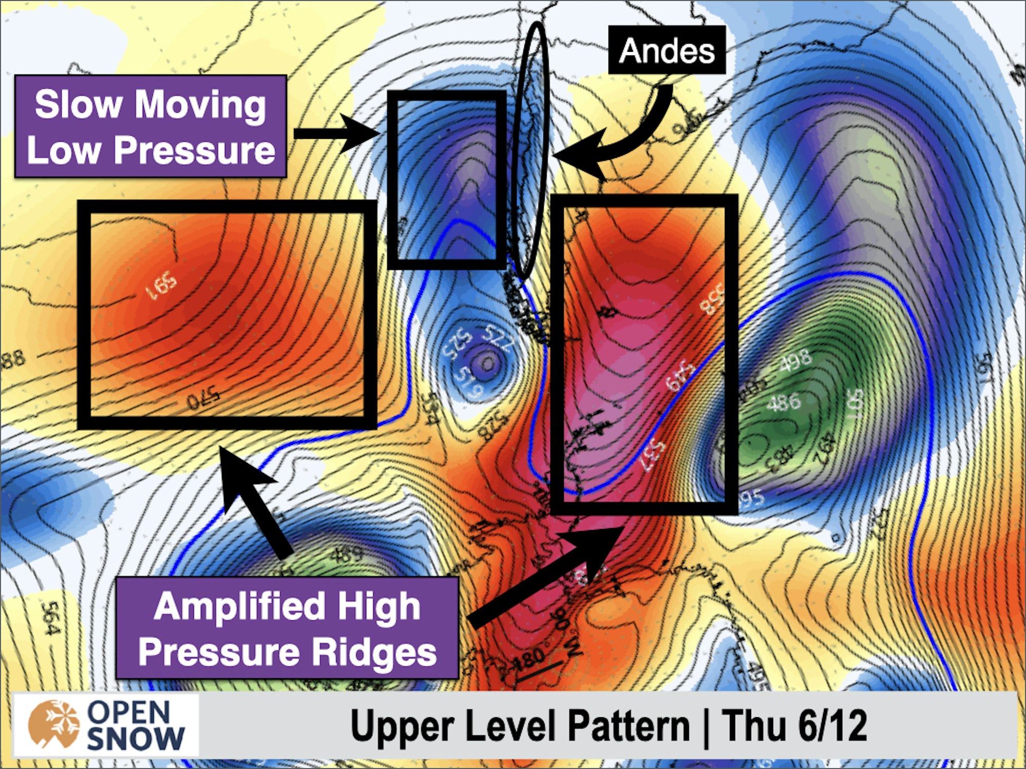
Stone’s models call for two high-pressure ridges to meet with an incoming low-pressure system moving in from the Pacific Ocean, as illustrated in the visual above. When they meet, he says, “This amplified ridge-trough-ridge pattern will be slow to break down, resulting in an extended period of low pressure and storminess between these ridges over the Andes.”
This is far from an isolated incident, with many ski resorts expecting two waves of heavy snow. The first cycle should hit on Thursday, June 12, into Friday, followed by a brief 24-hour calm, and then into the second storm cycle starting on Sunday. We’ll keep you posted as the storm develops, and with any luck, we’ll have plenty of pow clips to blow up your social feed with.
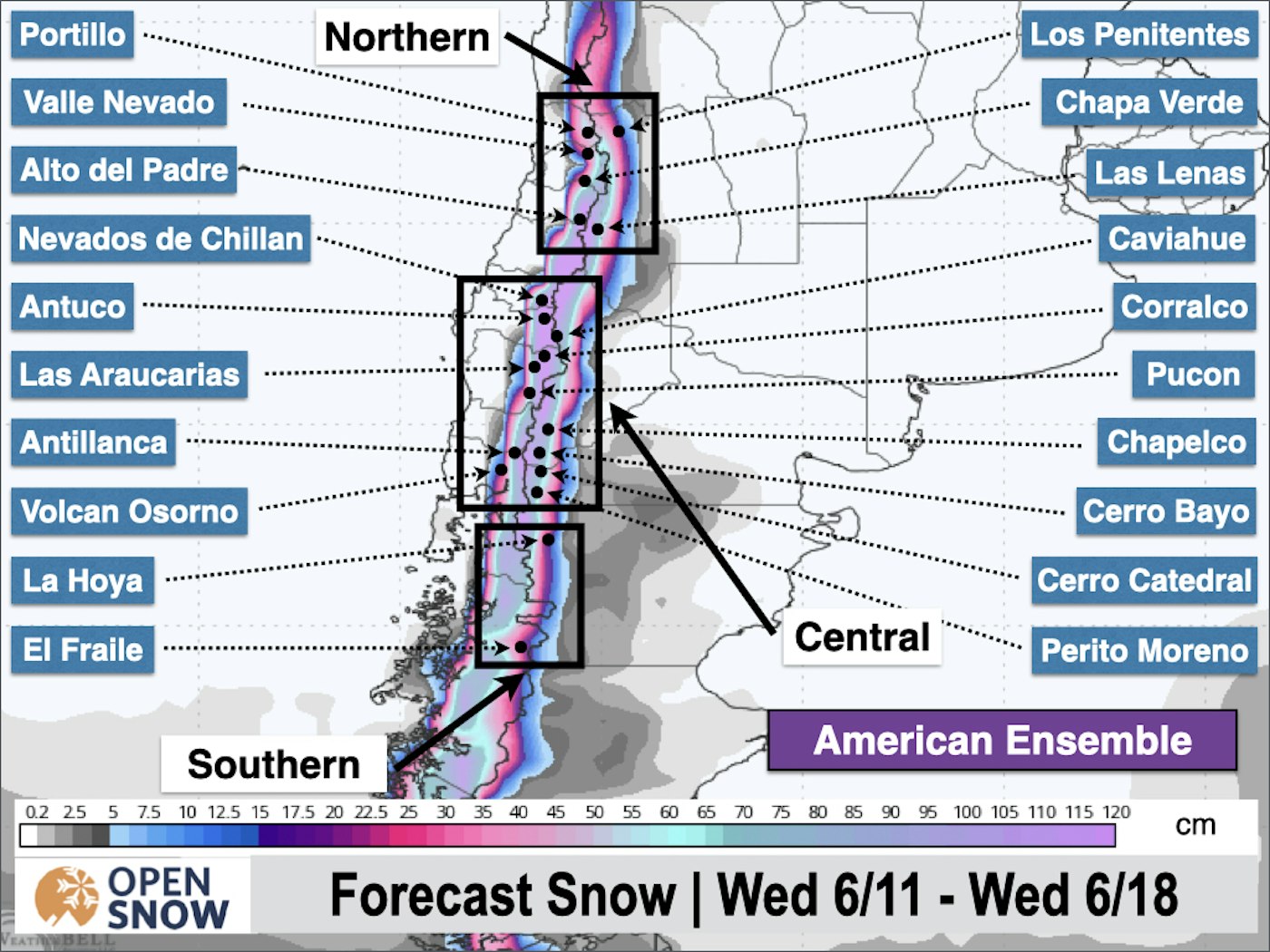
Projected 10-Day Storm Totals as of 6/11/25
Nevados de Chillan – 116″
Valle Nevado – 78″
El Colorado – 72″
La Parva – 72″
Ski Portillo – 68″