[juicebox gallery_id=”179″]
Words and photos by Jeff Cricco.
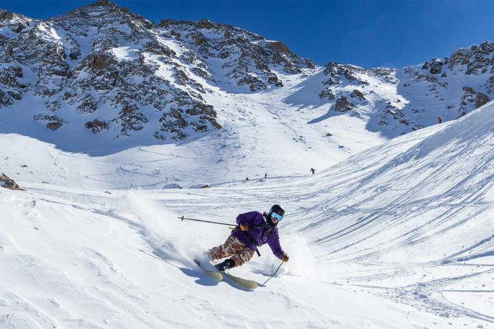
Two springs ago I had the opportunity to ski and shoot with Aspen-based athletes Pete Gaston and Whit Boucher. We spent a long day touring in a somewhat unsuccessful search for nuggets of fresh snow in Colorado’s San Juan Mountains. After finding only a few slash-worthy pillows, we retreated back to town for a few beers. The conversation turned toward the role of weather in the powder junkie’s life and how the latest snowfall ultimately determines whether a trip winds up stellar or lame.
Deep into the conversation and libations, Pete and Whit recalled trips they had taken to Jackson Hole, Alaska and British Columbia by way of a friend’s plane, which was parked at the Aspen-Pitkin County Airport.
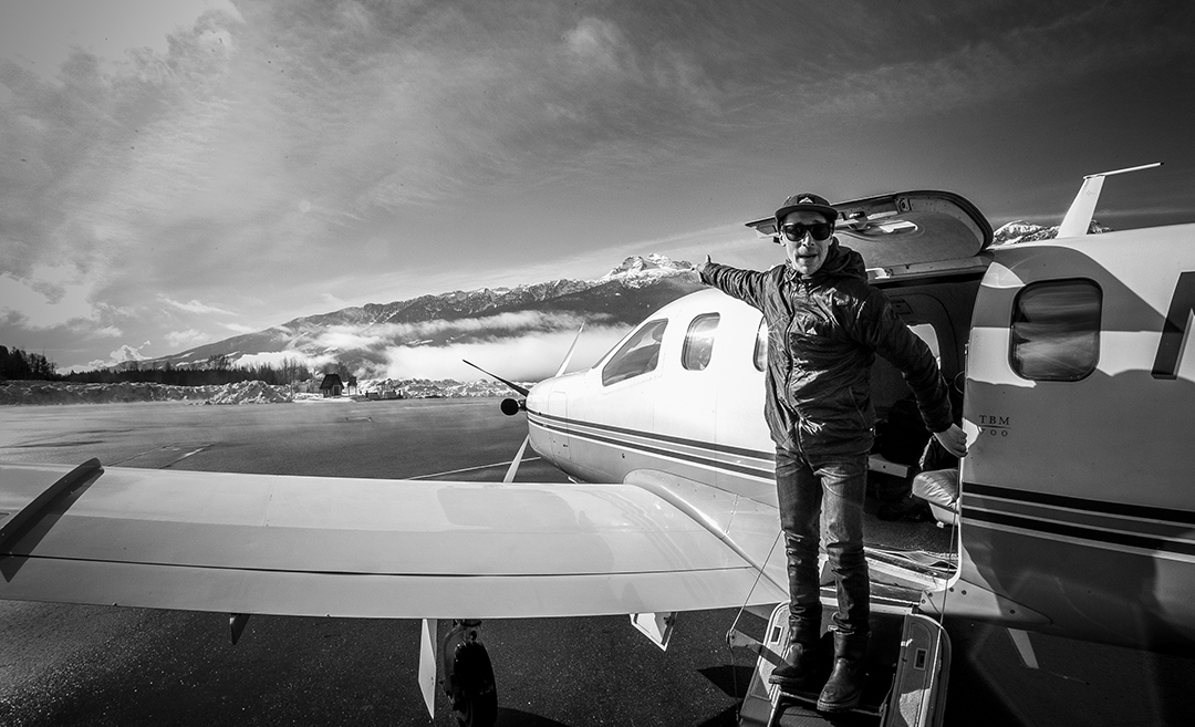
The single-engine prop could carry four passengers with gear at a cruising speed of 350 mph, and with that kind of whip, it was possible to hit any mountain in western North America in a half a day. I smelled opportunity and started scheming.
As we began to plan a trip, we started to focus more on the powder and less on the location. We needed to figure out the finer details of storm and weather forecasting. In addition to being friends with a pilot, Pete happened to be buddy-buddy with a crack powder snow meteorologist by the name of Joel Gratz. His site, opensnow.com has become the skier’s go-to resource for reliable forecasts. Some even say Gratz is the most famous person in Colorado after maybe John Elway. So, a two-week-long trip with sick skiers, a turbo-prop plane and Joel Gratz as our own personal forecaster? The thought of this trip was making my cornice grow.
I’ve been a pseudo weather forecaster for years. It comes with being a ski photographer. I started educating myself after too many occurrences of stormy conditions turning to bluebird earlier than predicted, leaving me with my pants down—not ready to shoot. Now I try to track snow and stay one step ahead of the game.
Like many powder addicts, I began by looking at radar maps. I soon learned, however, that radar in the mountains is inherently inaccurate. The mountains themselves can actually block the radar beam. It’s possible for it to show nothing, even while it’s puking snow on the peaks.
I moved on to satellite maps that show both water vapor and clouds. Like radars, these colorful maps are fun to look at and help meteorologists understand the atmosphere. Yet they are only a snapshot of what’s going on in real time and don’t clearly indicate where a storm is headed. Plus, satellite maps show the view of the top of the clouds from space, whereas I only care about what’s falling out of the bottom of the clouds.
If radar and satellite images aren’t that useful, what else is there? More recently, I started relying more on what’s known simply as “trending.” This is arguably the most accurate way to forecast the weather, despite its being the oldest and least technologically advanced technique. You’ve heard the old joke, “Want to know what the weather is going to do? Go outside and look.” Well, that concept usually holds true, and it’s the basis of trending.
The idea is that if it’s been snowing a lot in Jackson Hole, WY, all season, there’s a good chance it’s going to keep snowing hard. On the other hand, if it’s been a low snow year at, say, Crested Butte, CO, then it’s likely going to be a crap year for snow as a whole. Weather patterns often get locked in for weeks, if not months, so looking at the current and recent conditions can be a great way to figure out what the future holds.
This is where our planning with Gratz started. It had been dumping in the northwestern Rockies for most of the season. Wyoming, Montana and Central Interior BC were doing well, and it was decided that we would focus on those regions and bank on continued good fortune.
Our pilot, Jason, had a line on the Wintertux Hut, up on the edge of the Sawtooths in Idaho. Up until that point, the state had only experienced an average season snow-wise, but we chose it as a good first location because of its proximity to Montana and British Columbia. From Idaho, we could get deep into BC in just a couple of hours. Joel provided a great short-term forecast, with a clear day to get us into Ketchum, followed by a few days of snowfall in Sun Valley and the surrounding hills. We picked up the key to the hut from Smith Optics’ headquarters in Ketchum before heading an hour north to Smiley Creek. Once there, we rented sleds and cruised up the Beaver Creek drainage to the privately owned hut, which sits at 8,000 feet. From there, everything was skin access and most runs were about 1,500 vertical feet from top to bottom.
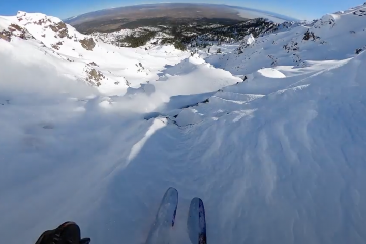
It was sleeting at the hut, and there was no white fluff hanging in the tree branches. Confidence was low. But as with most marginal days when you can’t really tell how good it is from the comfort of your couch, you have to roll the dice and live by the mantra “You don’t know until you go.” And so we went. We topped out at around 9,500 feet, but it was too gray to see much. The snow pack was sketchy, and we cautiously skied some tree runs. At least we’d be hunkered down that night in the thick of it, knowing it would likely get better.
Sure enough, Joel’s forecast held true. That night, the jet stream shifted south, dropping the temperature by 15 degrees. We woke up to over a foot of new snow on the doorstep. Watching forecasts of the jet stream—a “river” of air situated near the cruising altitude of most commercial aircraft—can key you in to multiple characteristics of a storm. If the jet stream is coming directly at your targeted mountain and predicted to stay that way, then it’s very likely that there’s going to be action. A southwest flow usually brings a moist, warm air mass, which can mean wet, heavy snow or rain at lower elevations. In an ideal scenario, an initial onslaught of heavy snow from the south lays down a wet, bondable layer of the white stuff that is usually conducive to snowpack cohesion. Then, as the storm passes through, the winds switch from southwest to northwest, making temperatures cooler and resulting in drier, fluffier snow falling from the sky.
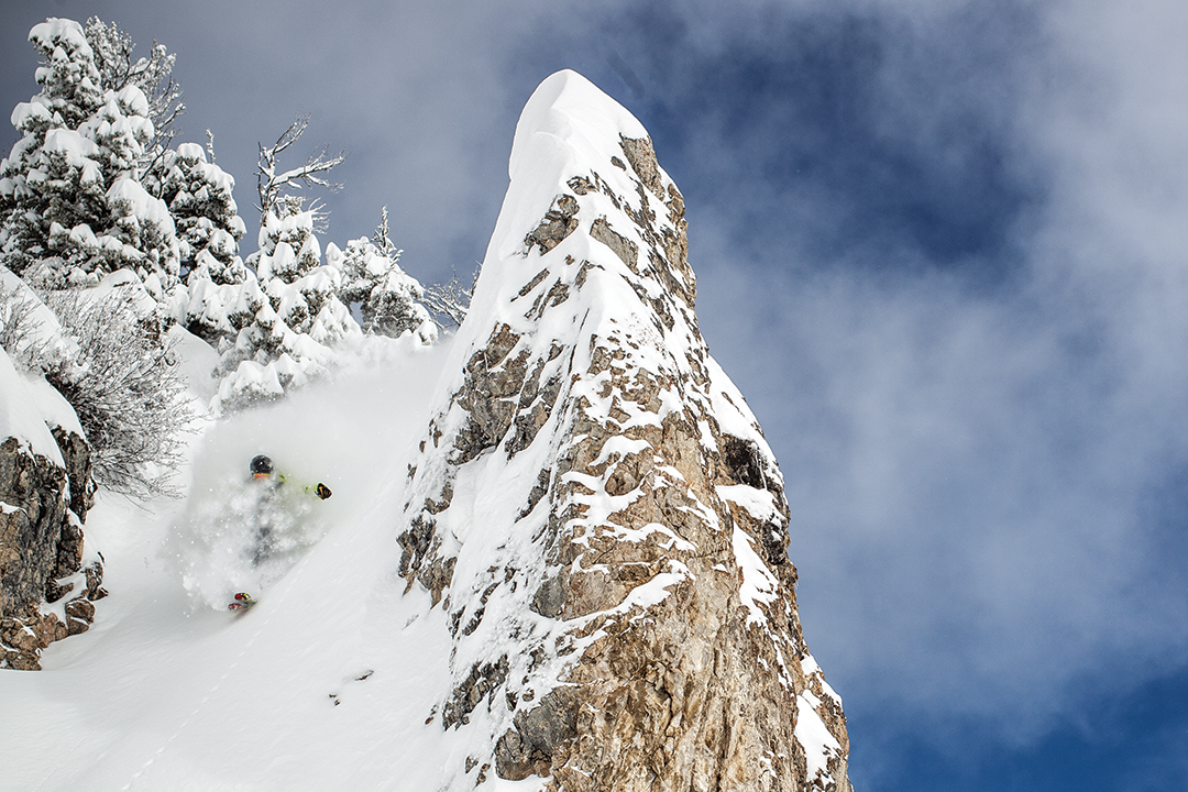
The overall result is a dense supportive base finished off with dry goose-feather pow on top. This is often referred to as “right-side up snow,” and it’s exactly what Joel predicted. All said, we had a day of heavy, dense snow and then two days of stable blower—ideal for slaying the deep and shooting photos.
With blue skies in the forecast, we opted to jet or should I say “prop” to our next location. The options within easy reach were Jackson, WY; Bozeman, MT; Fernie, BC; or Nelson, BC. After a couple of conference calls with Joel, the decision was made that we’d head to Bozeman and neighboring Bridger Bowl.
Bridger had been doing well all season, and the next approaching storm looked to be a good one. It was supposed to start out with warm temps, rain almost to midmountain and then cool down during the meat of the storm before finally giving way to multiple days of blue skies. Whit Boucher, crafty marketing guru for Strafe, had spent a few winters in Bozeman, meaning many powder days at Bridger. Whit made a call to fellow Strafe athlete Corey Seemann, who had been living in Bozeman after graduating high school. With the posse growing the stars were aligning for some serious shred—if the weather cooperated, that is. The first day at Bridger was horrendous, quite frankly. It was one of those wet, heavy days necessitating garbage bags and goggle squeegees. This marked another disappointing arrival, but Joel’s forecast was similar to the Wintertux prediction, so we kept the stoke high. After a half day of slushing it, we headed back to downtown Bozeman.
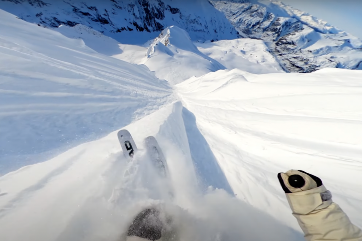
As Joel expected, the jet stream shifted and brought colder air down from the north. We woke up the next morning to a foot of snow, 3,000 feet below the peaks. Bingo! Bridger reported 23 inches overnight.
We ripped on-mountain at Bridger for an über-deep, overcast day with Seemann’s crew. The turns were the kind you would dream about. With smiles on our faces we then headed back down the valley for some Montucky Cold Snacks, a local brew served in a funky, electric-blue can. Calling it quits early worked out perfectly because the next morning, we woke up at the ass crack of dawn for a skinning assault on the peaks near Bridger. The boys found themselves some steep and deep lines to tackle. Then, we wondered yet again: Where to next?
When we embarked on the trip, the plan was, hopefully, to go out in a heli-skiing blaze of glory in Haines, AK. However at the beginning of the trip, Southeast Alaska had been extremely dry, and most heli operations were delaying their openings. But a dramatic new shift in weather patterns gave Joel confidence. Haines would start getting snow, he told us. We needed to point ’er to the northwest, so we set our sights on Revelstoke.
At that point Revelstoke, BC, had only experienced a decent snowfall season, but Joel was feeling a turn for the better—and soon. I inquired about how this prediction jived with the whole trending thing, and he explained that you have to understand the seasonal trends, while also keeping your eyes open to atmospheric changes that can tweak weather patterns drastically. His advice for the novice is to check out 16-day forecasts on free weather sites (see the GFS model on twisterdata.com). For serious weather geeks, you can create an account on weatherbell.com for access to maps produced by what’s supposedly the world’s most accurate weather model, monitored by a group in Europe.
To keep on giving us solid advice on where to go, Joel had to make sure not only that we stayed at the right elevation for the storms but also at the optimal latitude. The more elevation you gain, the colder it gets. For every 1,000 feet up, air temperatures drop from 3.3 degrees in very moist air to 5.5 degrees in dry air. Rejiggering the equation to factor in Revelstoke’s colder temps and lower elevations seemed to make forecasting here trickier still. But the guy is a whiz.
Being in Revelstoke got us closer to the coast, and therefore closer to Haines, and perhaps Whistler en route. So we winged out of Bozeman to Revy.
How much snow did we get in Revelstoke? Lots. Pete Gaston missed out because he had to fly back to Aspen from Bozeman. Whit, meantime, scored us another crew member in the form of ripping ski-boss gypsy, Oakley White-Allen, who a couple of years back had one of the highest-ever scoring runs at the Freeride World Tour competition on Revelstoke’s “Mack Daddy” face.
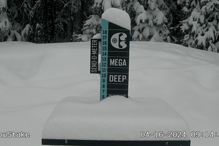
Every morning, we woke up to at least five inches of new snow, and during the daytime we received at least another five. After four days of powder skiing Revy style, we were at a crossroads. We needed to make our move if we wanted to get to Alaska. But with all things snow, there are so many variables—so many moving parts. From what we’d heard, Haines was bad. All of the new snow sat on horribly unstable layers from the early season drought. We could only hope there would be a quick avalanche cycle and then conditions would stabilize, but it was hard to say how things would play out.
Only one day later, I found out conditions had worsened in Haines. Far, far worse. An avalanche had killed renowned guide Aaron Karitis. Aaron was a friend and well-respected guide I had worked with on multiple Level 1 shoots in Alaska. It was a somber event, and the decision was made to stay in Revy.
In the end, we stayed in Revelstoke for a grand total of eight days. I believe the technical meteorological term to describe how much snow fell is “a buttload.” Our Strafe crew of Oakley, Whit and local high-school ripper and Salomon athlete Jake Teuton spent the days shooting and skiing in the surrounding Revy backcountry and Rogers Pass. Black and white days. No sun. Just snow.

For the climax of the trip, Whit—with the help of his helmet sponsor, POC—secured seats with Eagle Pass Heli, and we ended our powder hunt in the bird. And what a hunt it was. We closed things out with a 15-plus-run day, pillow popping and getting “over the grill” pow in the Monashee Mountains.
So, while you might not have a plane at your disposal, let this be a reminder that the pow is easier to chase than you might think. Best of luck to you, out there.
Related: Full Throttle Frenchie: Richard Permin can’t stop, won’t stop

4 thoughts on “Turbo Pow: Short term weather forecasting for nipple deep turns”
Comments are closed.