*Originally published in our February 2011 issue. Words and photos by Flip McCririck / TGR
Thomas Bay, Alaska, is known for two things, neither of them good. The Tlingit people, native to southeast Alaska, call it the “Bay of Death” because a landslide in 1750 wiped out an entire village and killed 500 people. White prospectors nicknamed the bay “Devil’s Country” because of reported sightings of “kushtaka,” shapeshifting creatures of Tlingit legend that can take the form of either man or otter.
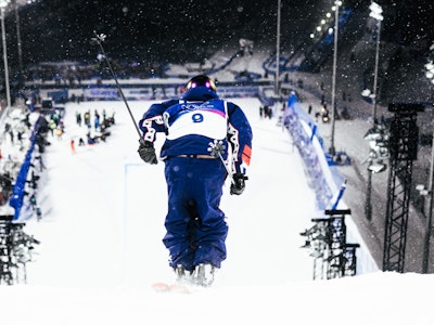
"Sage Cattabriga-Alosa hit this bergschrund after flashing spines above. It should go down as line of the year. I predict it will remain his line alone for many years to come."
Alaskan prospector Harry Colp cemented the “Devil’s Country” legend when he published a book recounting a run-in his friend had with kushtaka in 1900. Colp’s friend was searching for gold in Thomas Bay when he was attacked by a pack of creatures that were “neither men nor monkeys — yet looked like both. They were entirely sexless, their bodies covered with long coarse hair, except where the scabs and running sores had replaced it.” Colp’s friend escaped the kushtaka, handed his friends a large piece of gold-flecked quartz, then permanently left Alaska, insane.
Check out the entire photo essay gallery
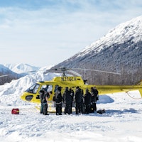
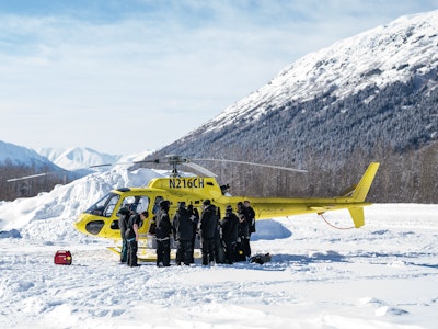
These ominous legends are on our minds as we take to the air over Thomas Bay early on Easter Sunday. The skiers are Dana Flahr, Ian McIntosh, Seth Morrison and Sage Cattabriga-Alosa, plus we have Todd Jones, guide Jim “Sarge” Conway, Josh Nielsen, Adam Clark, pilot Mike Wilson and me. We’re antsy to check snow and make a run after spending two weeks waiting in the rain in Petersburg. We fly the first leg across eight miles of water (Petersburg is an island) and stop to top off at our fuel cache in Thomas Bay, about 100 miles southeast of Juneau. A few rotting ships and hulls litter the shore. It is strangely silent, lifeless. The mouth of the Devil’s Country, exactly as Colp described it.
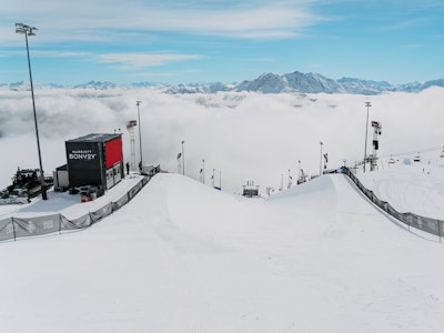
We fly east toward the Stikine Icecap; the Witch’s Cauldron is boiling up a thick cloudbank. Stikine is a “dead” glacier, a glacier that has stopped moving. The 6,700 foot face of the Devil’s Thumb pokes through the soup. The peak dominates the surroundings, and rises through three climate zones. The northwest face remains unclimbed. We fly to the edge of our permit zone, the Canadian border at the end of the Baird Glacier amidst jagged teeth surrounded by miles of ice.
This exploration is the culmination of a few years of brainstorming and planning amongst athletes, guides, pilots, cinematographers and photographers. Exploring a new zone is a serious undertaking. When Ian “MapIntosh” first arrived, he took advantage of a rare blue day, chartered an airplane and flew the whole zone with a GPS and a camera. He took his findings, and along with guides Sarge and Johnny B, made a wall map with all the vitals: ramps, couloirs, spines, location, aspect all mapped out. Today it’s trophy-hunting time, and we film probably 15 lines, until on the last run of the day, Dana takes an ugly tumble and blows his knee.
Check out the entire photo essay gallery
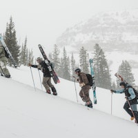
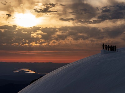
We arrive back to sheeting drizzle in Petersburg, the start of another storm. We put Dana on a plane, and pick up Daron Rahlves. Then we wait. We entertain ourselves exploring the island and its surroundings, sailing, taking a jet boat ride to check out the world’s southernmost tidal glacier. After a week, we’re rewarded with a five-day run. This type of clearing is rare for a place that gets 100 inches of rain annually, and we take full advantage. The scale is so huge that vets like Sage, Seth, Daron and Ian have to give the mountains a closer second look. In the middle of this Olympian wilderness, satisfaction and stoke are in the air. We know that we’re finding lines that have never been skied and will likely never be skied again. This is why we came here: Our own piece of quartz flecked with gold.
Thomas Bay is remote and the skiing is largely unattainable, but the photo essay that follows is, I hope, the best way to impart what it’s like to ski Alaska’s Bay of Death.